Other ID: none
Status: Completed
Organization(s): USGS, Woods Hole Coastal and Marine Science Center
Funding Program(s):
Principal Investigator(s): Lawrence Poppe
Affiliate Investigator(s): Ralph Lewis - Connecticut State Geologist
Information Specialist(s): Lawrence Poppe, Nancy K. Soderberg
Data Type(s): Imagery: Photo, Imagery: Video, Location-Elevation: Navigation, Sampling: Geology, Seismics: Sub Bottom Profiler, Sonar: Sidescan, Sonar: Single Beam
Scientific Purpose/Goals: Ground truth the New Haven Harbor sidescan survey and collect near-shore reconnaissance sidescan sonar lines around the Sound to interpolate between previously collected samples.
Vehicle(s):
Start Port/Location: Milford, CT
End Port/Location: Old Lyme, CT
Start Date: 1998-03-06
End Date: 1998-03-17
Equipment Used: DGPS, Edgetech Sidescan sonar, Q-MIPS sidescan sonar system, ODOM 200 kHz depth recorder, Van Veen grab sampler, Osprey camera system, 3.5 kHz
Information to be Derived:
Summary of Activity and Data Gathered:
Staff: Dann Blackwood, Eric Haase, David Nichols, Lawrence Poppe, Alex Robinson
Affiliate Staff:
Ralph Lewis
Mary DiGiacomo-Cohen - CT-DEP
Notes: Original Center People field contained: Chief Scientist - Larry Poppe, Photographer - Dann Blackwood, PST - Alex Robinson, PST - Eric Haase, Marine Seismic Specialist - Dave Nichols.
Project = Long Island Sound Environmental Studies, Long Island Sound Environmental Studies
Location:
Long Island Sound, Connecticut, United States, North America, North Atlantic;
| Boundaries | |||
|---|---|---|---|
| North: 41.3 | South: 40.8833 | West: -73.75 | East: -72.0333 |
Platform(s):
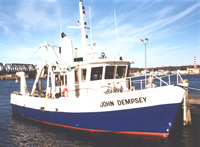 Dempsey |
Poppe, L.J., Polloni, C., eds., 1998, Long Island Sound environmental studies: U.S. Geological Survey Open-File Report (98-502), https://doi.org/10.3133/ofr98502.
Poppe, L.J., Robinson, A.C., Blackwood, D., Lewis, R.S., and Cohen-DiGiacomo, M.L., 1998, The distribution of surficial sediments in New Haven Harbor, Connecticut, and the New Haven dumping grounds, north-central Long Island Sound: U.S. Geological Survey Open-File Report 98-217, https://doi.org/10.3133/ofr98217.
| Title | Survey Equipment | Description |
|---|---|---|
| Navigation log | DGPS | GPS and P-Code navigation and Odom fathometer performance, start and end times, comments. Also lists personnel. |
| Navigation log | DGPS | GPS and P-Code navigation computer printout. |
| Sample log | Van Veen grab sampler | March 7, 1998 video camera transect times and locations, still photo locations, bottom descriptions, sample locations and comments |
| Sample log | Van Veen grab sampler | March 7-8, 1998 video camera transect times and locations, still photo locations, bottom descriptions, sample locations and comments. |
| ISIS log | Edgetech Sidescan sonar | ISIS system log of file and line changes, data collection notes, filenames. |
| Survey Equipment | Survey Info | Data Type(s) | Data Collected |
|---|---|---|---|
| DGPS | --- | Navigation | 1998-006-FA-LN-001 (Floppy disk(s) containing NAV DGPS L1-16, NAV DGPS L17-21, NAV DGPS L22-34, NAV DGPS L35-36, NAV DGPS L37-40, NAV DGPS, ) |
| Edgetech Sidescan sonar | --- | Sidescan | 1998-006-FA-SO-001 (Digital tape(s) of SSS DF1000 L1-16, SSS DF1000 L17-21, SSS DF1000 L22-34, SSS DF1000 L35-36, SSS DF1000 L37-40, ) |
| Q-MIPS sidescan sonar system | --- | Sidescan | |
| ODOM 200 kHz depth recorder | --- | Single Beam | |
| Van Veen grab sampler | --- | Geology | 1998-006-FA-SC-001 (GRAB samples) |
| Osprey camera system | --- | Photo Video | 1998-006-FA-PH-001 (CD ROM disk of 3.5K ELICS LINE 1-40, NAV, 3.5 K ELICS SEG-Y L1-29, 3.5 K ELICS SEG-Y L30-40, BOTTOMPHOTO LI SOUND, ) |
| 3.5 kHz | --- | Sub Bottom Profiler | 1998-006-FA-SE-001 (CD ROM disk of 3.5K ELICS LINE 1-40, NAV, 3.5 K ELICS SEG-Y L1-29, 3.5 K ELICS SEG-Y L30-40, BOTTOMPHOTO LI SOUND, ) |
