Other ID: none
Status: Completed
Organization(s): USGS, Woods Hole Coastal and Marine Science Center
Funding Program(s):
Principal Investigator(s): William Schwab, E. Robert Thieler
Affiliate Investigator(s): Paul Gayes - Coastal Carolina University
Information Specialist(s): E. Robert Thieler
Data Type(s): Location-Elevation: Navigation, Sampling: Geology, Seismics: Boomer, Sonar: Sidescan
Scientific Purpose/Goals: Vibracore in APEX/Southern Long Island study areas - daylight hours. Run boomer/sidescan overnights.
Vehicle(s):
Start Port/Location: Sandy Hook, NJ
End Port/Location: Norfolk, VA
Start Date: 1998-05-26
End Date: 1998-06-02
Equipment Used: Alpine Vibracorer, Boomer, Sidescan sonar, HYPACK, Van Veen grab sampler, Single channel hydrophone
Information to be Derived:
Summary of Activity and Data Gathered: Got a few good vibracores and some nice-looking boomer data.
Staff: David Nichols, E. Robert Thieler, Glynn Williams
Affiliate Staff:
Paul Gayes
Neal Gielstra
Joey Jenkins - CCU; Dan Lanier - TAMU; Laura Libbey - Duke
Notes: Information from Foghorn: vibracoring unit from CCU, boomer/Klein/ISIS from CCU
Van Veen grab sampler, ELICS, OYO, wire baskets (5);
Location:
New York-New Jersey Bight Apex, United States, North America, North Atlantic;
| Boundaries | |||
|---|---|---|---|
| North: 40.7807724 | South: 40.18237042 | West: -73.87542135 | East: -72.55706197 |
Platform(s):
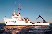
 Ferrel |
Hill, J.C., Thieler, E.R., Nichols, D.R., and Williams, G.F., 2001, Archive of boomer subbottom data collected during USGS Cruise FERL 98009, New York Bight, Raritan Bay, Long Island, 26 May-2 June, 1998: U.S. Geological Survey Open-File Report 2001-47, https://doi.org/10.3133/ofr0147.
FAN 1998-009-FA has data viewable in the GeoMappApp/Virtual Ocean applications. To view this data in these applications go to http://www.geomapapp.org/ and http://www.virtualocean.org/. See the instructions for locating USGS data in these applications. You can also view the imagery created from the SEGY data at https://cmgds.marine.usgs.gov/images.php?cruise=1998-009-FA.
| Survey Equipment | Survey Info | Data Type(s) | Data Collected |
|---|---|---|---|
| Alpine Vibracorer | --- | Geology | 1998-009-FA-SC-001 (CORE samples) |
| Boomer | --- | Boomer | |
| Sidescan sonar | --- | Sidescan | 1998-009-FA-SO-001 (Digital tape(s) of SSS L11-17, SSS L18-20, ) |
| HYPACK | --- | Navigation | 1998-009-FA-LN-001 (Floppy disk(s) containing NAV HYPACK, NAV HYPACK, ) |
| Van Veen grab sampler | --- | Geology | |
| Single channel hydrophone | --- | Air Gun / Water Gun Boomer Bubble Gun Sparker Sub Bottom Profiler | 1998-009-FA-SE-001 (CD ROM disk of BOOM ELICS LINE 1-5,8-20, BOOM SEG-Y RAW 1-5,8-10, BOOM SEG-Y RAW 11-17, BOOM SEG-Y PROCESSED, ) 1998-009-FA-SE-002 (Raw seismic data) 1998-009-FA-SE-002-01 (Processed SEGY seismic data) Boomer seismic data |