Other ID: ISB9817
Status: Completed
Organization(s): USGS, Woods Hole Coastal and Marine Science Center
Funding Program(s):
Principal Investigator(s): Page Valentine
Affiliate Investigator(s): Peter Auster - NOAA/UCONN
Information Specialist(s): Page Valentine
Data Type(s): Imagery: Video, Sampling: Biology, Sampling: Geology, Imagery: Photo, Location-Elevation: Navigation
Scientific Purpose/Goals: Sampling, video, and photography of the sea bed; conduct biological habitat surveys.
Vehicle(s):
Start Port/Location: Woods Hole, MA
End Port/Location: Woods Hole, MA
Start Date: 1998-07-16
End Date: 1998-07-30
Equipment Used: Video camera - deep sea, Camera- deep sea, SeaBOSS, P-code GPS
Information to be Derived:
Summary of Activity and Data Gathered: 428 photo/video stations; 274 sediment samples collected.
Staff: Dann Blackwood, Christopher F. Polloni, Page Valentine, Kenneth F. Parolski, Jessica Baker, Rebecca E. Deusser, Tanya Unger
Affiliate Staff:
J. Ranganathan; Biologists from NOAA/UCONN: P. Auster
J. Lake
J. Lindholm
L. Petros
Notes: Revised 6-2-98: July 15, mob in Woods Hole. July 16, at sea. July 23, change personnel in Gloucester. July 30, demob in Woods Hole. Original Center People field contained: D. Blackwood, T. Unger, J. Baker, R. Deusser, P. Valentine, K. Parolski, C. Polloni, J. Ranganathan.
Project = Stellwagen Bank NMS Mapping Project, Stellwagen Bank NMS Mapping Project
Location:
Stellwagen Bank, North America, North Atlantic;
| Boundaries | |||
|---|---|---|---|
| North: 42.8 | South: 42.083 | West: -70.6 | East: -70.033 |
Platform(s):
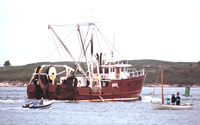 Isabel S |
Valentine, P.C., Baker, J.L., Unger, T.S., Scully, L.A., and Fuller, S.J., 2005, Sea floor image maps showing topography, sun-illuminated topography, backscatter intensity, ruggedness, slope, and the distribution of boulder ridges and bedrock outcrops in the Stellwagen Bank National Marine Sanctuary region off Boston, Massachusetts: U.S. Geological Survey Scientific Investigations Map 2840, https://doi.org/10.3133/sim2840.
Valentine, P.C., and Cross, V.A., 2023, Geospatial datasets of seabed topography, sediment mobility, and the distribution of geologic substrates in quadrangle 5 of the Stellwagen Bank National Marine Sanctuary region offshore of Boston, Massachusetts: U.S. Geological Survey data release, https://doi.org/10.5066/P9W9BN3S.
Valentine, P.C., and Gallea, L.B., 2015, Seabed maps showing topography, ruggedness, backscatter intensity, sediment mobility, and the distribution of geologic substrates in quadrangle 6 of the Stellwagen Bank National Marine Sanctuary region offshore of Boston, Massachusetts: U.S. Geological Survey Scientific Investigations Map 3341, 10 sheets, scale 1:25,000, and 21-p. pamphlet, https://doi.org/10.3133/sim3341.
Valentine, P.C., Gallea, L.B., Blackwood, D.S., and Twomey, E.R., 2010, Seabed photographs, sediment texture analyses, and sun-illuminated sea floor topography in the Stellwagen Bank National Marine Sanctuary region off Boston, Massachusetts: U.S. Geological Survey Data Series 469, available at https://doi.org/10.3133/ds469.
| Survey Equipment | Survey Info | Data Type(s) | Data Collected |
|---|---|---|---|
| Video camera - deep sea | --- | Video | |
| Camera- deep sea | --- | Photo | 1998-017-FA-PH-001 (CD ROM disk of BOTTOMPHOTO STELL JD197, BOTTOMPHOTO STELL JD197, BOTTOMPHOTO STELL JD198, BOTTOMPHOTO STELL JD199, BOTTOMPHOTO STELL JD200, BOTTOMPHOTO STELL JD201, BOTTOMPHOTO STELL JD202, BOTTOMPHOTO STELL JD203, BOTTOMPHOTO STELL JD204, BOTTOMPHOTO STELL JD205, BOTTOMPHOTO STELL JD206, BOTTOMPHOTO STELL JD207, BOTTOMPHOTO STELL JD208, ) |
| SeaBOSS | --- | Surveys (biological) Experiments (biological) Species ID Photo Video Geology Biology | 1998-017-FA-SC-001 (GRAB samples) |
| P-code GPS | --- | Navigation |
