Other ID: none
Status: Completed
Organization(s): USGS, Woods Hole Coastal and Marine Science Center
Funding Program(s):
Principal Investigator(s): Page Valentine
Affiliate Investigator(s): Jeremy Collie - URI
Information Specialist(s): Page Valentine
Data Type(s): Sampling: Geology, Sampling: Biology, Imagery: Video, Imagery: Photo, Location-Elevation: Navigation
Scientific Purpose/Goals: Sampling, video, photography of the sea bed; biologial habitat surveys with submersible.
Vehicle(s):
Start Port/Location: Woods Hole, MA
End Port/Location: Gloucester, MA
Start Date: 1998-08-14
End Date: 1998-08-23
Equipment Used: Sediment traps, Dredge, Video camera - deep sea, Grab sampler, Camera- deep sea, Amphipod traps, P-code GPS
Information to be Derived: Grain size analysis; Habitat maps;
Summary of Activity and Data Gathered: 12 submersible dives (photo and video); 12 biol. dredge stations; 10 amphipod traps; 26 photo/video stations.
Staff: Dann Blackwood, Jessica Baker, Tanya Unger
Affiliate Staff:
Biologists from URI
Notes: Project = Georges Bank Habitats Project, Georges Bank Habitats Project
Information from Foghorn: Video, photo, sampling system with winch, P-code navigation, Geolink software w/computer;
Location:
eastern Georges Bank, United States, Canada, North America, North Atlantic;
| Boundaries | |||
|---|---|---|---|
| North: 42.25 | South: 41.75 | West: -66.53 | East: -66.416 |
Platform(s):
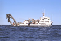 Edwin Link |
| Survey Equipment | Survey Info | Data Type(s) | Data Collected |
|---|---|---|---|
| Sediment traps | --- | Geology | |
| Dredge | --- | Biology Geology | |
| Video camera - deep sea | --- | Video | |
| Grab sampler | --- | Biology Geology | |
| Camera- deep sea | --- | Photo | |
| Amphipod traps | --- | Biology | |
| P-code GPS | --- | Navigation |
