Other ID: none
Status: Completed
Organization(s): USGS, Woods Hole Coastal and Marine Science Center
Funding Program(s):
Principal Investigator(s): Bradford Butman
Affiliate Investigator(s): Steve Anderson, Rick Trask, Woods Hole Oceanographic Institution
Information Specialist(s): Bradford Butman
Data Type(s): Environmental Data: CTD, Location-Elevation: Navigation, Time Series: Mooring (physical oceanography)
Scientific Purpose/Goals: Recover moorings in Stellwagen Basin for internal wave experiment. Conduct hydrographic survey.
Vehicle(s):
Start Port/Location: Portland, ME
End Port/Location: Woods Hole, MA
Start Date: 1998-08-30
End Date: 1998-09-03
Equipment Used: SBE 9 CTD, DGPS, Bottom platform
Information to be Derived: Time series data;
Summary of Activity and Data Gathered: USGS moorings recovered in Massachusetts Bay - Station A: Mooring 539 (surface buoy); Station B: Mooring 536 (surface buoy), 537 (tripod), 538 (subsurface); Station C: Mooring 533 (surface buoy), 534 (subsurface), 535 (tripod); 67 CTD casts. Moorings recovered: 7 (#533, 534, 535, 536, 537, 538 and 539 all deployed FA 98031 ARGO MAINE Aug. 3-7, 1998).
Staff: Jonathan Borden, Bradford Butman, Joseph S. Newell
Affiliate Staff:
Rick Trask
Will Ostrom
Bob Weller
Jason Gobat - Woods Hole Oceanographic Institution
Notes: Original Center People field contained: Brad Butman, Jonathan Borden; Joseph Newell (loading/unloading).
Project = Stellwagen Bank National Marine Sanctuary Mapping, Stellwagen Bank National Marine Sanctuary Mapping
Location:
Massachusetts Bay, Massachusetts, United States, North America, North Atlantic,
| Boundaries | |||
|---|---|---|---|
| North: 42.4167 | South: 42.1667 | West: -70.6667 | East: -70.25 |
Platform(s):
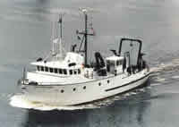 Argo Maine |
Bothner, M.H., and Butman, Bradford (eds.), 2007, Processes influencing the transport and fate of contaminated sediments in the coastal ocean—Boston Harbor and Massachusetts Bay: U.S. Geological Survey Circular 1302, 89 p., https://doi.org/10.3133/cir1302.
Butman, B., Alexander, P.S., Anderson, S.P., Lightsom, F.L., Scotti, A., and Beardsley, R.C., 2006, The Massachusetts Bay internal wave experiment, August 1998—data report: U.S. Geological Survey Data Series 85, Version 2.0, DVD-ROM, URL: https://doi.org/10.3133/ds85.
Scotti, A., Beardsley, R.C., Butman, B., and Pineda, J., 2008, Shoaling of nonlinear internal waves in Massachusetts Bay: Journal of Geophysical Research - Oceans, v. 113 no. C08031, doi: 10.1029/2008JC004726.
Warner, J.C., Butman, B., and Dalyander, P. S., 2008, Storm-driven sediment transport in Massachusetts Bay: Continental Shelf Research, v. 28 no. 2, doi: 10.1016/j.csr.2007.08.008.
Warner, J.C., Sherwood, Christopher R., Signell, Richard P., Harris, Courtney K., and Arango, Hernan G., 2008, Development of a three-dimensional, regional, coupled wave, current, and sediment-transport model: Computers and Geosciences, v. 34 no. 10, doi: 10.1016/j.cageo.2008.02.012.
| Survey Equipment | Survey Info | Data Type(s) | Data Collected |
|---|---|---|---|
| SBE 9 CTD | --- | CTD | |
| DGPS | --- | Navigation | |
| Bottom platform | --- | Mooring (physical oceanography) | 1998-032-FA-OM-001 (Mass Bay IWAVE mooring data) |
