Other ID: MNHA 9849
Status: Completed
Organization(s): USGS, Woods Hole Coastal and Marine Science Center
Funding Program(s):
Principal Investigator(s): Page Valentine
Affiliate Investigator(s): Wade Gough, USCG; John Sowles, Maine DEP
Information Specialist(s): Page Valentine
Data Type(s): Imagery: Video, Imagery: Photo, Sampling: Geology, Location-Elevation: Navigation
Scientific Purpose/Goals: Conduct sediment sampling for USCG around mercury-laden shipwreck M/V EMPIRE KNIGHT.
Vehicle(s):
Start Port/Location: Portland, ME
End Port/Location: Portland, ME
Start Date: 1998-11-01
End Date: 1998-11-05
Equipment Used: Video camera - deep sea, Camera- deep sea, SeaBOSS, P-code GPS
Information to be Derived: Samples and chemical analysis;
Summary of Activity and Data Gathered: Stations: 35; Sediment samples: 29; Bottom photos: 75 (1 photo CD); Video transects: 35 (7 tapes).
Staff: Dann Blackwood, Kenneth F. Parolski, Joseph S. Newell, Robert Barton
Affiliate Staff:
Wade Gough
USCG; John Sowles
ME DEP
Notes: Report prepared from planning documents and collected data. Mobilization will be on Sunday, Nov. 1, at USCG in Portland, ME. Demob planned for Thursday, Nov. 5, in Portland. Original Center People field contained: Dann Blackwood, Kenneth Parolski; Mob/demob: Joseph Newell, Robert Barton, Kenneth Parolski.
Information from Foghorn: New winch and video/photo system;P-code navigation;
Location:
coastal Maine, coastal New Hampshire, United States, North America, North Atlantic;
| Boundaries | |||
|---|---|---|---|
| North: 43.7 | South: 43 | West: -70.5 | East: -70 |
Platform(s):
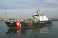 Marcus Hanna |
Butman, B., Bothner, M.H., Alexander, P.S., Lightsom, F.L., Martini, M.A., Gutierrez, B.T., and Strahle, W.S., 2004, Long-term oceanographic observations in western Massachusetts Bay offshore of Boston, Massachusetts; data report for 1989-2002: U.S. Geological Survey Digital Data Series DDS-74, Version 2.0, DVD-ROM, URL: https://doi.org/10.3133/ds74_v2.
Butman, B., Dalyander, P.S., Bothner, M.H., Borden, J., Casso, M.A., Gutierrez, B.T., Hastings, M.E., Lightsom, F.L., Martini, M.A., Montgomery, E.T., Rendigs, R.R., and Strahle, W.S., 2009, Long-term oceanographic observations in Massachusetts Bay, 1989 - 2006 (version 3): U.S. Geological Survey Data Series 74, https://doi.org/10.3133/ds74.
| Survey Equipment | Survey Info | Data Type(s) | Data Collected |
|---|---|---|---|
| Video camera - deep sea | --- | Video | |
| Camera- deep sea | --- | Photo | |
| SeaBOSS | --- | Surveys (biological) Experiments (biological) Species ID Photo Video Geology Biology | |
| P-code GPS | --- | Navigation |
