Other ID: S-10-99-SC
Status: Completed
Organization(s): USGS, Woods Hole Coastal and Marine Science Center
Funding Program(s):
Principal Investigator(s): Jonathan Borden
Affiliate Investigator(s): Marlene Noble
Information Specialist(s): Frances Lightsom
Data Type(s): Location-Elevation: Navigation, Time Series: Mooring (physical oceanography)
Scientific Purpose/Goals: Recover moorings #545 subsurface, #546 surface, #547 subsurface, #548 surface, #549 subsurface. Recover tripods #544 and 550.
Vehicle(s):
Start Port/Location: San Diego, CA
End Port/Location: San Diego, CA
Start Date: 1999-04-01
End Date: 1999-04-03
Equipment Used: GEOPROBE, DGPS
Information to be Derived:
Summary of Activity and Data Gathered: Moorings recovered: 7 (#544, 545, 546, 547, 548, 549 and 550 all deployed SPROUL FA 98048 Dec. 3-6, 1998).
Staff: Jonathan Borden, Joseph S. Newell, Richard Rendigs
Affiliate Staff:
From USGS Menlo Park: Marlene Noble
Joanne Thede Ferreira
David Gonzales. Marla Stone - Naval Post-graduate School
Notes: Post activity report by Jonathan Borden 10/12/1999. Original Center People field contained: At sea recovery: Jonathan Borden, Richard Rendigs. Shore side support: Joseph Newell (shipping).
Location:
Santa Monica Bay, California, United States, North America, North Pacific;
| Boundaries | |||
|---|---|---|---|
| North: 33.95 | South: 33.9 | West: -118.55 | East: -118.45 |
Platform(s):
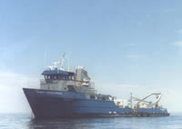 Robert Gordon Sproul |
| Survey Equipment | Survey Info | Data Type(s) | Data Collected |
|---|---|---|---|
| GEOPROBE | --- | Mooring (physical oceanography) | 1999-010-FA-OM-001 (mooring data) |
| DGPS | --- | Navigation |
