Other ID: ISBL9924
Status: Completed
Organization(s): USGS, Woods Hole Coastal and Marine Science Center
Funding Program(s):
Principal Investigator(s): Page Valentine
Affiliate Investigator(s):
Information Specialist(s): Page Valentine
Data Type(s): Biological Field Study: Experiments (biological), Biological Field Study: Surveys (biological), Imagery: Photo, Imagery: Video, Sampling: Biology, Sampling: Geology, Visual Identification: Species ID, Location-Elevation: Navigation
Scientific Purpose/Goals: Sampling, video, and photography to ground truth seabed imagery and define habitats.
Vehicle(s):
Start Port/Location: Woods Hole, MA
End Port/Location: Woods Hole, MA
Start Date: 1999-07-13
End Date: 1999-07-30
Equipment Used: SeaBOSS, P-code GPS
Information to be Derived:
Summary of Activity and Data Gathered: Mob Tues., June 13 in Woods Hole. Depart June 14. Crew change in Gloucester on Wed., June 21. Demob June 28 or 29 in Woods Hole. Total stations 442; video 442; sediment samples 357 stations.
Staff: Brad Barr, Dann Blackwood, Bradford Butman, Laura Hayes, Jeremy Malczyk, Andee Marksamer, Tammie Middleton, Joseph S. Newell, Kenneth F. Parolski, Christopher F. Polloni, Richard Rendigs, Page Valentine, David Walsh, Nancy K. Soderberg
Affiliate Staff:
Notes: Original Center People field contained: Page Valentine, Dann Blackwood, Tammie Middleton, Jeremy Malczyk, Laura Hayes, Brad Barr, Brad Butman, Ken Parolski, Joe Newell (mob/demob), Chris Polloni, David Walsh, Nancy Soderberg, Andee Marksamer, Rick Rendigs.
Project = Stellwagen Bank NMS Mapping Project, Stellwagen Bank NMS Mapping Project
Information from Foghorn: SEABOSS video sampler with winch, video van, P-code navigation, geolink;
Location:
Stellwagen Bank NMS region, United States, North America, North Atlantic;
| Boundaries | |||
|---|---|---|---|
| North: 42.8 | South: 42.08 | West: -70.6 | East: -70.03 |
Platform(s):
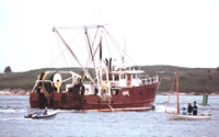 Isabel S |
Bothner, M.H., and Butman, Bradford (eds.), 2007, Processes influencing the transport and fate of contaminated sediments in the coastal ocean—Boston Harbor and Massachusetts Bay: U.S. Geological Survey Circular 1302, 89 p., https://doi.org/10.3133/cir1302.
Butman, B., Alexander, P.S., Anderson, S.P., Lightsom, F.L., Scotti, A., and Beardsley, R.C., 2006, The Massachusetts Bay internal wave experiment, August 1998—data report: U.S. Geological Survey Data Series 85, Version 2.0, DVD-ROM, URL: https://doi.org/10.3133/ds85.
Gutierrez, B.T., Butman, B., and Blackwood, D.S., 2001, Photographs of the sea floor in western Massachusetts Bay, offshore of Boston, Massachusetts, July, 1999: U.S. Geological Survey Open-File Report 00-427, CD-ROM, URL: https://doi.org/10.3133/ofr2000427.
Pendleton, E.A., Barnhardt, W.A., Baldwin, W.E., Foster, D.S., Schwab, W.C., Andrews, B.D., and Ackerman, S.D., 2015, Sea-floor texture and physiographic zones of the inner continental shelf from Salisbury to Nahant, Massachusetts, including the Merrimack Embayment and Western Massachusetts Bay: U.S. Geological Survey Open-File Report 2015–1153, 36 p., 1 appendix, https://doi.org/10.3133/ofr20151153.
Valentine, P.C., Baker, J.L., Unger, T.S., Scully, L.A., and Fuller, S.J., 2005, Sea floor image maps showing topography, sun-illuminated topography, backscatter intensity, ruggedness, slope, and the distribution of boulder ridges and bedrock outcrops in the Stellwagen Bank National Marine Sanctuary region off Boston, Massachusetts: U.S. Geological Survey Scientific Investigations Map 2840, https://doi.org/10.3133/sim2840.
Valentine, P.C., Gallea, L.B., Blackwood, D.S., and Twomey, E.R., 2010, Seabed photographs, sediment texture analyses, and sun-illuminated sea floor topography in the Stellwagen Bank National Marine Sanctuary region off Boston, Massachusetts: U.S. Geological Survey Data Series 469, available at https://doi.org/10.3133/ds469.
| Title | Survey Equipment | Description |
|---|---|---|
| Sample log | SeaBOSS | Field log describing data acquisition by Van Veen sampler, video camera and 35-mm still camera. Two volumes combined into a single PDF. |
| Survey Equipment | Survey Info | Data Type(s) | Data Collected |
|---|---|---|---|
| SeaBOSS | --- | Surveys (biological) Experiments (biological) Species ID Photo Video Geology Biology | 1999-024-FA-NL-001-01 (Field log describing data acquisition by Van Veen sampler, video camera and 35-mm still camera.) 1999-024-FA-PH-001 (CD ROM disk of BOTTOMPHOTO STELL ) 1999-024-FA-SC-001 (GRAB samples) |
| P-code GPS | --- | Navigation |
