Other ID: none
Status: Completed
Organization(s): USGS, Woods Hole Coastal and Marine Science Center
Funding Program(s):
Principal Investigator(s): Gregory Miller
Affiliate Investigator(s):
Information Specialist(s): Gregory Miller
Data Type(s): Seismics: Ocean Bottom Seismometer, Location-Elevation: Navigation
Scientific Purpose/Goals: To recover OBSes in support of LARSE II.
Vehicle(s):
Start Port/Location: Los Angeles, CA
End Port/Location: Los Angeles, CA
Start Date: 1999-11-16
End Date: 1999-11-16
Equipment Used: Ocean Bottom Seismometer, GPS (wh)
Information to be Derived:
Summary of Activity and Data Gathered: 5 OBSes were deployed, but only 4 were recovered. These instruments were deployed in support of a land seismic line with explosive sources.
Staff: Gregory Miller, Jefferey Nealon
Affiliate Staff:
Notes: Original Center People field contained: Greg Miller - tech; Jeff Nealon- tech.
Project = LARSE II, LARSE II
Location:
Los Angeles, California, United States, North America, North Pacific,
| Boundaries | |||
|---|---|---|---|
| North: 34 | South: 33.9 | West: -118.6 | East: -118.5 |
Platform(s):
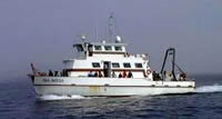 Sea Watch |
| Survey Equipment | Survey Info | Data Type(s) | Data Collected |
|---|---|---|---|
| Ocean Bottom Seismometer | --- | Ocean Bottom Seismometer | |
| GPS (wh) | --- | Navigation |
