Other ID: IB E-13-00-NB
Status: Completed
Organization(s): USGS, Woods Hole Coastal and Marine Science Center
Funding Program(s):
Principal Investigator(s): Bradford Butman
Affiliate Investigator(s): Woods Hole Oceanographic Institution
Information Specialist(s): Bradford Butman
Data Type(s): Biological Field Study: Experiments (biological), Biological Field Study: Surveys (biological), Imagery: Photo, Imagery: Video, Location-Elevation: Navigation, Sampling: Biology, Sampling: Geology, Time Series: Mooring (physical oceanography), Visual Identification: Species ID
Scientific Purpose/Goals: Recover moorings in New York Bight, conduct CTD observations, conduct bottom video observations, and collect grab samples.
Vehicle(s):
Start Port/Location: Narragansett, RI
End Port/Location: Narragansett, RI
Start Date: 2000-04-14
End Date: 2000-04-18
Equipment Used: GPS (wh), SeaBOSS, Digital camera, Bottom platform
Information to be Derived:
Summary of Activity and Data Gathered: Tripods recovered: 5 (#595, 599, 601, 603 and 604, all deployed FA 99006 OCEANUS OC354 Dec. 3-7, 1999). Tripod not recovered: 1 (#597, recovered later during FA 00054 CONNECTICUT Jun. 27-28, 2000). Surface moorings recovered: 5 (#594, 596, 598, 600 and 602, all deployed FA 99006 OCEANUS OC354 Dec. 3-7, 1999). 9 CTD stations completed; 35 SEABOSS stations completed.
Staff: Dann Blackwood, Jonathan Borden, Bradford Butman, Jessica M. Cote, Erin Galvin, Ben Gutierrez, Courtney Harris, Marinna Martini, Richard Rendigs, Sunita Shah, David Walsh, Marilyn ten Brink
Affiliate Staff:
Joanne Ferreira; Peter Traykovski (WHOI)
Notes: Original Center People field contained: Brad Butman, Dann Blackwood, Jonathan Borden, Jessica Cote, Erin Galvin, Benjamin Gutierrez, Courtney Harris, Marinna Martini, Richard Rendigs, Sunita Shah, Marilyn ten Brink, Joanne Ferreira, and David Walsh.
Project = Pollutant Transp and Accumulation in the New York Bight, Pollutant Transp and Accumulation in the New York Bight
Location:
New York Bight, United States, North America, North Atlantic;
| Boundaries | |||
|---|---|---|---|
| North: 40.5 | South: 39.75 | West: -73.93 | East: -72.9 |
Platform(s):
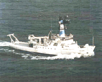 Endeavor |
Butman, B., Alexander, P.S., Harris, C.K., Traykovski, P.A., ten Brink, M.B., Lightsom, F.S., and Martini, M.A., 2003, Oceanographic observations in the Hudson Shelf Valley, December 1999 - April 2000—Data report: U.S. Geological Survey Open-File Report 02-217, DVD-ROM, URL: https://doi.org/10.3133/ofr02217.
Butman, B., Gutierrez, B.T., Buchholtz ten Brink, M.R., Schwab, W.C., Blackwood, D.S., Mecray, E.L., and Middleton, T.J., 2003, Photographs of the sea floor offshore of New York and New Jersey: U.S. Geological Survey Open-File Report 01-470, DVD-ROM, URL: https://doi.org/10.3133/ofr2001470.
Harris, C.K., Butman, Bradford, and Traykovski, Peter, 2003, Winter-time circulation and sediment transport in the Hudson Shelf Valley: Continental Shelf Research, v. 23 no. 8, doi: 10.1016/S0278-4343(03)00025-6.
| Title | Survey Equipment | Description |
|---|---|---|
| Navigation log | GPS (wh) | GPS navigation printout containing five-minute fixes with some handwritten annotation. |
| CTD log | (document not focused on specific equipment) | CTD station log including position, sea state, depth, and pressure. |
| Survey Equipment | Survey Info | Data Type(s) | Data Collected |
|---|---|---|---|
| GPS (wh) | --- | Navigation | |
| SeaBOSS | --- | Surveys (biological) Experiments (biological) Species ID Photo Video Geology Biology | 2000-013-FA-PH-001 (CD ROM disk of DECK CORE,GRAB SHOTS, BOTTOM PHOTO NY BIGHT *, BOTTOM PHOTO NY BIGHT *, BOTTOM PHOTO NY BIGHT *, ) 2000-013-FA-SC-001 (GRAB samples) |
| Digital camera | --- | Photo | 2000-013-FA-PH-002 (Deck photos of field activity operations) |
| Bottom platform | --- | Mooring (physical oceanography) |
