Other ID: IB S-1-01-SR
Status: Completed
Organization(s): USGS, Woods Hole Coastal and Marine Science Center
Funding Program(s):
Principal Investigator(s): William Schwab
Affiliate Investigator(s):
Information Specialist(s): Jane Denny
Data Type(s): Location-Elevation: Navigation, Seismics: Sub Bottom Profiler, Sonar: Interferometric, Sonar: Sidescan, Seismics: Boomer
Scientific Purpose/Goals: Map inner shelf off Charleston, SC.
Vehicle(s):
Start Port/Location: Wilmington, NC
End Port/Location: Charleston, SC
Start Date: 2001-07-20
End Date: 2001-07-26
Equipment Used: SIS1000 Chirp Sonar, GeoPulse uniboom, Single channel hydrophone, DGPS, SIS1000 Sidescan sonar, SEA SWATHplus-M 234 kHz
Information to be Derived:
Summary of Activity and Data Gathered: The wind blew from 20-35 kts the entire time (seas 6-10 ft). The water depth of the study area ranged from 4-6 m. Therefore, we never put the gear in the water. Cruise a total failure due to weather.
Staff: Mark Capone, Jane Denny, Erika Hammar-Klose, Thomas O'Brien, William Schwab
Affiliate Staff:
Shawn Dadisman (USGS-St. Pete)
Mike Boyle (USGS-Menlo Park)
Paul Gayes (Coastal Carolina U.)
Notes: Original Center People field contained: Bill Schwab (PI), Tom O'Brien (electronics technician), Erika Hammar-Klose (data processing), Mark Capone (data processing), Jane Denny (demobilization/transportation).
Project = South Carolina Coastal Erosion, South Carolina Coastal Erosion
Information from Foghorn: Submetrix sidescan, SIS-1000, GeoPulse Boomer, DGPS Navigation, Geophysical and Processing Vans;
Location:
Central South Carolina, United States, North America, North Atlantic;
| Boundaries | |||
|---|---|---|---|
| North: 32.69452 | South: 32.6001 | West: -79.8529 | East: -79.71887 |
Platform(s):
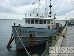 Atlantic Surveyor |
| Survey Equipment | Survey Info | Data Type(s) | Data Collected |
|---|---|---|---|
| SIS1000 Chirp Sonar | --- | Sub Bottom Profiler | |
| GeoPulse uniboom | --- | Boomer | |
| Single channel hydrophone | --- | Air Gun / Water Gun Boomer Bubble Gun Sparker Sub Bottom Profiler | |
| DGPS | --- | Navigation | |
| SIS1000 Sidescan sonar | --- | Sidescan | |
| SEA SWATHplus-M 234 kHz | --- | Interferometric |
