Other ID: RB03-05
Status: Completed
Organization(s): USGS, Woods Hole Coastal and Marine Science Center
Funding Program(s):
Principal Investigator(s): Uri Ten Brink
Affiliate Investigator(s): NOAA Ocean Exploration
Information Specialist(s): Christopher F. Polloni, Nancy K. Soderberg
Data Type(s): Environmental Data: CTD, Environmental Data: Temperature, Location-Elevation: Navigation, Sonar: Multibeam
Scientific Purpose/Goals: Complete multibeam bathymetry survey of the Puerto Rico trench.
Vehicle(s):
Start Port/Location: St. Maarten, Dutch Antilles
End Port/Location: St. Petersburg, FL
Start Date: 2003-08-28
End Date: 2003-09-04
Equipment Used: Temperature and salinity, DGPS, SeaBeam 2112
Information to be Derived: Sea floor map;
Summary of Activity and Data Gathered: SeaBeam bathy: 1085 km.
Staff: William Danforth, Christopher F. Polloni, Uri Ten Brink
Affiliate Staff:
Khoura Gibson - Teacher at Sea; Eran Kaplan - Student; Joram ten Brink - Film maker
Notes: Original Center People field contained: Uri ten Brink - Chief Scientist; William Danforth - Data processing; Christopher Polloni - Data archiving and display.
Project = Caribbean tsunami and earthquake hazard, Caribbean tsunami and earthquake hazard
Location:
Puerto Rico trench, Puerto Rico, United States, North America, North Atlantic;
| Boundaries | |||
|---|---|---|---|
| North: 20.42930021 | South: 18.5016041 | West: -69.38602173 | East: -61.99584961 |
Platform(s):
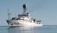 Ronald H. Brown |
ten Brink, U.S., Danforth, W.W., and Polloni, C.F., 2013, Final report and archive of the swath bathymetry and ancillary data collected in the Puerto Rico Trench region in 2002 and 2003: U.S. Geological Survey Open-File Report 2006-1210, https://doi.org/10.3133/ofr20061210.
Whitmore, P., ten Brink, Uri, Caropolo, Michael, Huerfano-Moreno, Victor, Knight, William, Sammler, William, and Sandrik, Al, 2009, NOAA/West Coast and Alaska Tsunami Warning Center Atlantic Ocean response criteria: Science of Tsunami Hazards, v. 28 no. 2, URL: http://tsunamisociety.org/282WhitmoreEtAla.pdf.
| Survey Equipment | Survey Info | Data Type(s) | Data Collected |
|---|---|---|---|
| Temperature and salinity | --- | CTD Temperature | |
| DGPS | --- | Navigation | |
| SeaBeam 2112 | --- | Multibeam |
