Other ID: none
Status: Completed
Organization(s): USGS, Woods Hole Coastal and Marine Science Center
Funding Program(s):
Principal Investigator(s): Marinna Martini
Affiliate Investigator(s): George Voulgaris - USC; Patrick Barnard - USGS Menlo Park
Information Specialist(s): Frances Lightsom
Data Type(s): Location-Elevation: Navigation, Time Series: Mooring (physical oceanography)
Scientific Purpose/Goals: Turn around tripods. Replace instruments under buoys, fix buoy lights.
Vehicle(s):
Start Port/Location: Wilmington, NC
End Port/Location: Wilmington, NC
Start Date: 2004-01-20
End Date: 2004-01-30
Equipment Used: DGPS, Current
Information to be Derived:
Summary of Activity and Data Gathered: Moorings recovered: 13 (#720, 722, 724, 726, 728, 731, 732, 733 all deployed FA 03048 DAN MOORE Oct. 27-28, 2003; #721, 723, 725, 727, 729 all deployed FA 03046 NANCY FOSTER Oct. 3-4, 2003. #730, a USC trawl-resistant bottom mount, was not located by the divers after several tries; recovered FA 04008 DAN MOORE Apr. 22-24, 2004). Moorings deployed: 13 (#740, 741, 742, 743, 744, 745, 746, 747, 748, 749, 751, 752, 753 all recovered FA 04008 DAN MOORE Apr. 22-24, 2004).
Staff: Philip Bernard, Jonathan Borden, Marinna Martini, Stephen Ruane, John Warner
Affiliate Staff:
Patrick Barnard (USGS-Menlo Park); University of South Carolina: George Voulgaris
Benjamin Gutierrez
Stephanie Olney
Young Kim
Notes: Divers are being contracted separately. This field activity is associated with FA 03046, FA 03048 and FA 04008. See paper and electronic mooring logs for additional information regarding deployment and recovery dates and relationships between 720-series and 740-series moorings. Original Center People field contained: Jonathan Borden, Stephen Ruane, Marinna Martini, John Warner, Patrick Barnard (Menlo Park) in the field; Philip Bernard shipping.
Project = South Carolina Coastal Erosion Studies, South Carolina Coastal Erosion Studies
Location:
Myrtle Beach, South Carolina, United States, North America, North Atlantic;
| Boundaries | |||
|---|---|---|---|
| North: 33.78422039 | South: 33.62834215 | West: -78.86535645 | East: -77.19941652 |
Platform(s):
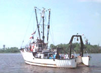 Dan Moore |
Barnhardt, W.A. (ed.), 2009, Coastal change along the shore of northeastern South Carolina—the South Carolina coastal erosion study: U.S. Geological Survey Circular 1339, 77 p., https://doi.org/10.3133/cir1339.
Montgomery, E., Sherwood, C., 2013, Studying seafloor bedforms using autonomous stationary imaging and profiling sonars: , OCEANS'13 MTS/IEEE Proceedings Paper. pp. 1–7 URL: http://ieeexplore.ieee.org/xpl/freeabs_all.jsp?arnumber=6741159&abstractAccess=no&userType=inst.
Barnhardt, W.A. (ed.), 2009, Coastal change along the shore of northeastern South Carolina—the South Carolina coastal erosion study: U.S. Geological Survey Open-File Report 2008-1206, URL: https://doi.org/10.3133/ofr20081206.
Sullivan, C.M., Warner, J.C., Martini, M.A., Voulgaris, G., Work, P.A., Haas, K.A., and Hanes, D., 2006, South Carolina coastal erosion study data report for observations October 2003 - April 2004: U.S. Geological Survey Open-File Report, https://doi.org/10.3133/ofr20051429.
| Survey Equipment | Survey Info | Data Type(s) | Data Collected |
|---|---|---|---|
| DGPS | --- | Navigation | |
| Current | --- | Mooring (physical oceanography) | 2004-007-FA-OM-001 (Myrtle Beach mooring data) |
