Other ID: FSTR0401
Status: Completed
Organization(s): USGS, Woods Hole Coastal and Marine Science Center
Funding Program(s):
Principal Investigator(s): Page Valentine
Affiliate Investigator(s): James Lindholm, SBNMS
Information Specialist(s): Page Valentine
Data Type(s): Biological Field Study: Experiments (biological), Biological Field Study: Surveys (biological), Imagery: Photo, Imagery: Video, Location-Elevation: Navigation, Sampling: Biology, Sampling: Geology, Visual Identification: Species ID
Scientific Purpose/Goals: Habitat studies and mapping.
Vehicle(s):
Start Port/Location: WHOI, Woods Hole, MA
End Port/Location: WHOI, Woods Hole, MA
Start Date: 2004-06-20
End Date: 2004-06-26
Equipment Used: SeaBOSS, Grab sampler, P-code GPS, Digital camera, Smith-MacIntyre grab
Information to be Derived: Grain size analysis; Habitat maps; Benthic invertebrate analysis;
Summary of Activity and Data Gathered: 37 video/photo transects; 12 invertebrate biology samples; 6 grain-size analysis samples.
Staff: Dann Blackwood, Sarah Fuller, Page Valentine, Charles Worley
Affiliate Staff:
Kari Heinonen
UCONN
biologist; Betsy Grannis
U. Maine
biologist
Notes: UPDATED June 9, 2004: Mobe at WHOI on Sunday, June 20. Demobe at WHOI on Saturday morning, June 26. Original Center People field contained: Page Valentine, Dann Blackwood, Sarah Fuller, Chuck Worley (for mobe and demobe).
Project = SBNMS Habitat Mapping, SBNMS Habitat Mapping
Information from Foghorn: center equipment Navigation - P-code; SEABOSS; Smith-Macintyre grab, U. Maine
Location:
Stellwagen Bank, Gulf of Maine, Massachusetts, United States, North America, North Atlantic;
| Boundaries | |||
|---|---|---|---|
| North: 42.6282995 | South: 42.18873138 | West: -70.65730303 | East: -70.11759009 |
Platform(s):
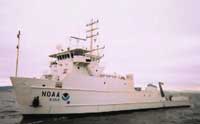 Nancy Foster |
Bothner, M.H., and Butman, Bradford (eds.), 2007, Processes influencing the transport and fate of contaminated sediments in the coastal ocean—Boston Harbor and Massachusetts Bay: U.S. Geological Survey Circular 1302, 89 p., https://doi.org/10.3133/cir1302.
Valentine, P.C., Baker, J.L., Unger, T.S., Scully, L.A., and Fuller, S.J., 2005, Sea floor image maps showing topography, sun-illuminated topography, backscatter intensity, ruggedness, slope, and the distribution of boulder ridges and bedrock outcrops in the Stellwagen Bank National Marine Sanctuary region off Boston, Massachusetts: U.S. Geological Survey Scientific Investigations Map 2840, https://doi.org/10.3133/sim2840.
Valentine, P.C., and Gallea, L.B., 2015, Seabed maps showing topography, ruggedness, backscatter intensity, sediment mobility, and the distribution of geologic substrates in quadrangle 6 of the Stellwagen Bank National Marine Sanctuary region offshore of Boston, Massachusetts: U.S. Geological Survey Scientific Investigations Map 3341, 10 sheets, scale 1:25,000, and 21-p. pamphlet, https://doi.org/10.3133/sim3341.
Valentine, P.C., Gallea, L.B., Blackwood, D.S., and Twomey, E.R., 2010, Seabed photographs, sediment texture analyses, and sun-illuminated sea floor topography in the Stellwagen Bank National Marine Sanctuary region off Boston, Massachusetts: U.S. Geological Survey Data Series 469, available at https://doi.org/10.3133/ds469.
| Survey Equipment | Survey Info | Data Type(s) | Data Collected |
|---|---|---|---|
| SeaBOSS | --- | Surveys (biological) Experiments (biological) Species ID Photo Video Geology Biology | 2004-010-FA-SC-001 (grab samples) 2004-010-FA-PH-001 (CD ROM disk of BOTTOM PHOTO STELL ) |
| Grab sampler | --- | Biology Geology | |
| P-code GPS | --- | Navigation | |
| Digital camera | --- | Photo | 2004-010-FA-PH-002 (Deck photos of field activity operations) |
| Smith-MacIntyre grab | --- | Biology Geology |
