Other ID: MH48-05
Status: Completed
Organization(s): USGS, Woods Hole Coastal and Marine Science Center
Funding Program(s):
Principal Investigator(s): Michael Bothner
Affiliate Investigator(s):
Information Specialist(s): Michael Casso, Frances Lightsom
Data Type(s): Environmental Data: Dissolved Oxygen, Geochemical: Experiments (geochemical), Imagery: Photo, Time Series: Mooring (physical oceanography)
Scientific Purpose/Goals: Exchange moorings, collect sediment cores, and conduct geochemical experiments at long-term sites in Massachusetts Bay. Collect additional cores at long-term monitoring stations in Boston Harbor.
Vehicle(s):
Start Port/Location: U.S. Coast Guard Base, Boston, MA
End Port/Location: U.S. Coast Guard Base, Boston, MA
Start Date: 2005-05-18
End Date: 2005-05-19
Equipment Used: Oxygen profiling system from Sayles, Benthic Chambers, Digital camera, Bottom platform
Information to be Derived: Time series data; Samples and chemical analysis; Grain size analysis;
Summary of Activity and Data Gathered: Moorings recovered: 2 (#776 and 777 both deployed FA 05003 MARCUS HANNA Feb. 9, 2005). Moorings deployed: 3 (#786 and 788 both recovered FA 05038 MARCUS HANNA Sep. 28-29, 2005; #787 part washed ashore Cohasset May 26, 2005, remainder recovered FA 05023 LOONEY Jun. 3, 2005). A large tripod with azide Honjo bottles and two Anderson traps, a small tripod, and a small subsurface mooring with formalin Honjo bottles were deployed on 5/18/05. Anderson trap 514 had the timer and the sodium azide poison. All traps were lost shortly after deployment due to strong NE storms. A large subsurface mooring was redeployed on 6/7/05. Two cores were taken at Station 2 and four cores were taken at Station 10 on 5/18/05. Two cores were taken at Station BH3 and seven cores were taken at Station 3 on 5/19/05. The oxygen sensor and the benthic chamber were deployed twice on 5/19/05. The ship had engine trouble requiring the coring of Station 4 to occur at a later time.
Staff: Sandy Baldwin, Dann Blackwood, Jonathan Borden, Michael Bothner, Michael Casso, Dirk Koopmans, Marinna Martini, Richard Rendigs, Stephen Ruane
Affiliate Staff:
Joanne Goudreau (WHOI) - deploying equipment from WHOI; Bill Martin (WHOI) - working on cores at the dock.
Notes: Original Center People field contained: Sea going scientists from USGS: Sandy Baldwin, Dann Blackwood*, Jonathan Borden*, Mike Bothner, Michael Casso, Marinna Martini*, Richard Rendigs, Stephen Ruane*. Working on cores at the dock: Dirk Koopmans. Asterisk (*) denotes acct. 2921-BOF86; otherwise acct. 2921-BOF96.
Project = Coastal Geologic Processes in the Northeast U.S., Coastal Geologic Processes in the Northeast U.S.
Location:
Boston Harbor, Massachusetts Bay, Massachusetts, United States, North America, North Atlantic;
| Boundaries | |||
|---|---|---|---|
| North: 42.4 | South: 42.33 | West: -71.166 | East: -70.666 |
Platform(s):
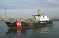 Marcus Hanna |
Bothner, M.H., and Butman, Bradford (eds.), 2007, Processes influencing the transport and fate of contaminated sediments in the coastal ocean—Boston Harbor and Massachusetts Bay: U.S. Geological Survey Circular 1302, 89 p., https://doi.org/10.3133/cir1302.
Butman, B., Bothner, M.H., Alexander, P.S., Lightsom, F.L., Martini, M.A., Gutierrez, B.T., and Strahle, W.S., 2004, Long-term oceanographic observations in western Massachusetts Bay offshore of Boston, Massachusetts; data report for 1989-2002: U.S. Geological Survey Digital Data Series DDS-74, Version 2.0, DVD-ROM, URL: https://doi.org/10.3133/ds74_v2.
Butman, B., Dalyander, P.S., Bothner, M.H., Borden, J., Casso, M.A., Gutierrez, B.T., Hastings, M.E., Lightsom, F.L., Martini, M.A., Montgomery, E.T., Rendigs, R.R., and Strahle, W.S., 2009, Long-term oceanographic observations in Massachusetts Bay, 1989 - 2006 (version 3): U.S. Geological Survey Data Series 74, https://doi.org/10.3133/ds74.
Butman, B., Dalyander, P.S., Bothner, M.H., and Lange, W.N., 2008, Time-series photographs of the sea floor in western Massachusetts Bay, 1996 - 2005: U.S. Geological Survey Data Series 266, https://doi.org/10.3133/ds266.
| Survey Equipment | Survey Info | Data Type(s) | Data Collected |
|---|---|---|---|
| Oxygen profiling system from Sayles | --- | Dissolved Oxygen | |
| Benthic Chambers | --- | Experiments (geochemical) | |
| Digital camera | --- | Photo | 2005-022-FA-PH-001 (Deck photos of field activity operations) |
| Bottom platform | --- | Mooring (physical oceanography) | 2005-022-FA-OM-001 (Western Mass Bay mooring data) |
