Other ID: none
Status: Completed
Organization(s): USGS, Woods Hole Coastal and Marine Science Center
Funding Program(s):
Principal Investigator(s): Jonathan Borden
Affiliate Investigator(s):
Information Specialist(s): Frances Lightsom
Data Type(s): Imagery: Photo, Location-Elevation: Navigation, Time Series: Mooring (physical oceanography)
Scientific Purpose/Goals: Dive for remains of collapsed mooring 787. Inspect tripod 786 and mooring 788 to determine their status after the northeast storm of 5/25/05.
Vehicle(s):
Start Port/Location: Boston, MA
End Port/Location: Boston, MA
Start Date: 2005-06-02
End Date: 2005-06-03
Equipment Used: Digital camera, DGPS, Bottom platform
Information to be Derived: Time series data;
Summary of Activity and Data Gathered: Bottom instruments (seacat, VMCM and Honjo) of mooring 787 successfully recovered. Divers report tripod is upright. Subsurface mooring 788 releases report that the mooring is upright.
Staff: Dann Blackwood, Jonathan Borden, Michael Casso, Richard Rendigs, Stephen Ruane
Affiliate Staff:
Notes: Project = Massachuestts Bay Long-Term, Massachuestts Bay Long-Term
Location:
Massachusetts Bay, Massachusetts, United States, North America, North Atlantic,
| Boundaries | |||
|---|---|---|---|
| North: 42.4 | South: 42.33 | West: -71.166 | East: -70.666 |
Platform(s):
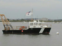 Looney |
Bothner, M.H., and Butman, Bradford (eds.), 2007, Processes influencing the transport and fate of contaminated sediments in the coastal ocean—Boston Harbor and Massachusetts Bay: U.S. Geological Survey Circular 1302, 89 p., https://doi.org/10.3133/cir1302.
Butman, B., Bothner, M.H., Alexander, P.S., Lightsom, F.L., Martini, M.A., Gutierrez, B.T., and Strahle, W.S., 2004, Long-term oceanographic observations in western Massachusetts Bay offshore of Boston, Massachusetts; data report for 1989-2002: U.S. Geological Survey Digital Data Series DDS-74, Version 2.0, DVD-ROM, URL: https://doi.org/10.3133/ds74_v2.
Butman, B., Dalyander, P.S., Bothner, M.H., Borden, J., Casso, M.A., Gutierrez, B.T., Hastings, M.E., Lightsom, F.L., Martini, M.A., Montgomery, E.T., Rendigs, R.R., and Strahle, W.S., 2009, Long-term oceanographic observations in Massachusetts Bay, 1989 - 2006 (version 3): U.S. Geological Survey Data Series 74, https://doi.org/10.3133/ds74.
| Survey Equipment | Survey Info | Data Type(s) | Data Collected |
|---|---|---|---|
| Digital camera | --- | Photo | 2005-023-FA-PH-001 (Deck photos of field activity operations) |
| DGPS | --- | Navigation | |
| Bottom platform | --- | Mooring (physical oceanography) | 2005-023-FA-OM-001 (Western Mass Bay mooring data) |
