Other ID: none
Status: Completed
Organization(s): USGS, Woods Hole Coastal and Marine Science Center
Funding Program(s):
Principal Investigator(s): Lawrence Poppe
Affiliate Investigator(s):
Information Specialist(s): Lawrence Poppe
Data Type(s): Seismics: Sub Bottom Profiler
Scientific Purpose/Goals: 1. Multibeam bathymetric surveying for charting applications. 2. Collect chirp subbottom concurrently with NOAA's multibeam bathymetry to facilitate geological interpretations of DTMs, providing information on framework, internal structure of surface features, and morphology of bedforms.
Vehicle(s):
Start Port/Location: Boston, MA
End Port/Location: Norfolk, VA
Start Date: 2005-09-03
End Date: 2005-11-13
Equipment Used: Knudsen echo sounder 320B/R
Information to be Derived:
Summary of Activity and Data Gathered:
Staff: Lawrence Poppe
Affiliate Staff:
Notes:
Location:
Long Island Sound, New York, Connecticut, United States, North America, North Atlantic,
| Boundaries | |||
|---|---|---|---|
| North: 41.25458109 | South: 40.41266332 | West: -73.8831 | East: -71.55721029 |
Platform(s):
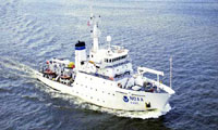
 Thomas Jefferson |
| Survey Equipment | Survey Info | Data Type(s) | Data Collected |
|---|---|---|---|
| Knudsen echo sounder 320B/R | --- | Sub Bottom Profiler |