Other ID: none
Status: Completed
Organization(s): USGS, St. Petersburg Coastal and Marine Science Center
Funding Program(s):
Principal Investigator(s): Lisa Osterman
Affiliate Investigator(s):
Information Specialist(s):
Data Type(s): Sampling: Chemistry, Sampling: Geology
Scientific Purpose/Goals: To collect sediment and water column samples in the Louisiana Shelf region
Vehicle(s):
Start Port/Location: Cocodrie, Louisiana
End Port/Location: Cocodrie, Louisiana
Start Date: 2005-10-14
End Date: 2005-10-19
Equipment Used: Box Corer, Surface grab sampler, Other, Water Sampler
Information to be Derived: Salinity, faunal assemblage, and geochronology
Summary of Activity and Data Gathered: Collected 6 box cores, 30 surface cores (multicorer), 12 water cloumn samples, and 41 surface grabs.
Staff: Marci Marot, Christopher Reich
Affiliate Staff:
Notes:
Location:
Louisiana Shelf - Gulf of Mexico, Louisiana
| Boundaries | |||
|---|---|---|---|
| North: 29 | South: 28 | West: -91 | East: -90 |
Platform(s):
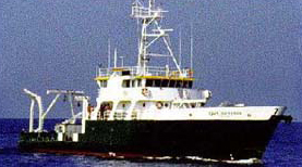 Cape Hatteras |
| Survey Equipment | Survey Info | Data Type(s) | Data Collected |
|---|---|---|---|
| Box Corer | --- | Biology Geology | |
| Surface grab sampler | --- | Biology Geology | |
| Other | --- | --- | --- |
| Water Sampler | --- | Chemistry |
