Other ID: S-1B-08-SC
Status: Completed
Organization(s): USGS, Woods Hole Coastal and Marine Science Center
Funding Program(s):
Principal Investigator(s): Jonathan Borden
Affiliate Investigator(s): Tom Lorenson, USGS-Menlo Park
Information Specialist(s): Jonathan Borden
Data Type(s): Imagery: Photo, Imagery: Video, Location-Elevation: Navigation
Scientific Purpose/Goals: ROV survey of Coal Oil Point Seeps in conjunction with SHEARWATER (08018) swath bathymetric cruise.
Vehicle(s):
Start Port/Location: Santa Barbara, CA
End Port/Location: Santa Barbara, CA
Start Date: 2008-03-17
End Date: 2008-03-19
Equipment Used: ROV, Omnistar
Information to be Derived: Sea floor map; Samples and chemical analysis;
Summary of Activity and Data Gathered: ROV work was a successful trial. Digital video from ROV; tar samples taken with grab; gas samples taken with sampler designed and built by Gerry Hatcher.
Staff: Philip Bernard, Jonathan Borden, Raymond E. Davis, Charles Worley
Affiliate Staff:
Tom Lorenson
USGS-MP
Chief Scientist; Gerry Hatcher
USGS-MP
Engineer; Ira Leifer
UCSB
Notes: Original Center People field contained: Jonathan Borden, ROV Pilot; Chuck Worley, Technician; PJ Bernard, Shipping; Ray Davis, Design/Fabrication.
Project = Sources, Transportation, and Fate of Natural Oil and Gas Seepages, Sources, Transportation, and Fate of Natural Oil and Gas Seepages
Location:
Santa Barbara Channel, Goleta, California, United States, North America, North Pacific;
| Boundaries | |||
|---|---|---|---|
| North: 34.41667 | South: 34.35 | West: -119.9167 | East: -119.81667 |
Platform(s):
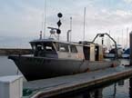 Zephyr |
| Survey Equipment | Survey Info | Data Type(s) | Data Collected |
|---|---|---|---|
| ROV | --- | Photo Video Biology Geology | 2008-005-FA-SC-001 (Tar and gas samples.) |
| Omnistar | --- | Navigation | 2008-005-FA-LN-001 (navigation data) |
