Other ID: S-1A-08-SC
Status: Completed
Organization(s): USGS, Woods Hole Coastal and Marine Science Center
Funding Program(s):
Principal Investigator(s): Charles Worley
Affiliate Investigator(s): Thomas Lorenson - Menlo Park
Information Specialist(s): Charles Worley
Data Type(s): Sonar: Interferometric, Location-Elevation: Navigation, Sonar: Sidescan
Scientific Purpose/Goals: Swath bathymetry mapping in area of Santa Barbara Channel Coal Oil Point seeps simultaneously with ZEPHYR sediment sampling and ROV videography cruise (FA 08005).
Vehicle(s):
Start Port/Location: Santa Barbara, CA
End Port/Location: Santa Barbara, CA
Start Date: 2008-03-10
End Date: 2008-03-19
Equipment Used: SEA SWATHplus-L 117 kHz, Sidescan sonar
Information to be Derived: Sea floor map; Bathymetric maps;
Summary of Activity and Data Gathered: Collected SWATH bathymetry digital data around oil seeps, trying to detect gas seeps in the water column.
Staff: Charles Worley
Affiliate Staff:
Thomas Lorenson
Chief Scientist - Menlo Park
Notes: Project = Sources, Transportation, and Fate of Natural Oil and Gas Seepages, Sources, Transportation, and Fate of Natural Oil and Gas Seepages
Location:
Santa Barbara Channel, Goleta, California, United States, North America, North Pacific;
| Boundaries | |||
|---|---|---|---|
| North: 34.41666 | South: 34.35 | West: -119.917 | East: -119.81666 |
Platform(s):
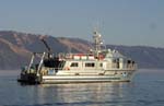 Shearwater |
| Survey Equipment | Survey Info | Data Type(s) | Data Collected |
|---|---|---|---|
| SEA SWATHplus-L 117 kHz | --- | Interferometric | 2008-018-FA-BA-001 (Swath bathymetric data.) |
| Sidescan sonar | --- | Sidescan |
