Other ID: T-30-08-MA
Status: Completed
Organization(s): USGS, Woods Hole Coastal and Marine Science Center
Funding Program(s):
Principal Investigator(s): Michael Bothner
Affiliate Investigator(s): Carl Lamborg, WHOI
Information Specialist(s): Michael Bothner, PARTNER
Data Type(s): Environmental Data: Conductivity, Imagery: Video, Location-Elevation: Navigation, Sampling: Chemistry
Scientific Purpose/Goals: Collect water samples from Oyster Pond for mercury analysis.
Vehicle(s):
Start Port/Location: Surf Drive, Falmouth, MA
End Port/Location: Surf Drive, Falmouth, MA
Start Date: 2008-07-16
End Date: 2008-07-16
Equipment Used: Niskin bottle, Video camera - deep sea, YSI multiparameter sonde, GPS (wh)
Information to be Derived:
Summary of Activity and Data Gathered: 7 samples were collected in the south basin of Oyster Pond, 6 samples in the north basin. Profiles of water column properties were recorded. Videos of particles in the water column were collected.
Staff: Michael Bothner
Affiliate Staff:
Dr. Carl Lamborg (Co-Chief Scientist)
April Abbott (WHOI summer science student)
Notes: Data Curator: Carl Lamborg.
Project = Coastal Geological Processes and Long-Term, Coastal Geological Processes and Long-Term
Location:
Oyster Pond, Falmouth, Massachusetts, United States, North America;
| Boundaries | |||
|---|---|---|---|
| North: 41.547 | South: 41.536 | West: -70.642 | East: -70.636 |
Platform(s):
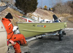 Terrapin |
| Survey Equipment | Survey Info | Data Type(s) | Data Collected |
|---|---|---|---|
| Niskin bottle | --- | Chemistry | 2008-030-FA-SC-001 (13 water samples: 7 from the south basin, 6 from the north basin.) |
| Video camera - deep sea | --- | Video | 2008-030-FA-NL-001 (Logs for VIDEO, ) |
| YSI multiparameter sonde | --- | Conductivity Dissolved Oxygen ORP pH Temperature | 2008-030-FA-GC-001 (YSI profiler water column properties: recorded temperature, salinity, conductivity, depth, DO2, pH, ORD potential from equipment in the field into a field notebook.) |
| GPS (wh) | --- | Navigation |
