Other ID: J-39-08-LI
Status: Completed
Organization(s): USGS, Woods Hole Coastal and Marine Science Center
Funding Program(s):
Principal Investigator(s): Lawrence Poppe
Affiliate Investigator(s): Office of Coast Survey, National Oceanic and Atmospheric Administration
Information Specialist(s): Lawrence Poppe, Nancy K. Soderberg
Data Type(s): Sonar: Multibeam, Sonar: Sound Velocity, Sonar: Sidescan, Location-Elevation: Navigation
Scientific Purpose/Goals: The ship will be acquiring multibeam bathymetry and backscatter datasets to update nautical charts. USGS participation facilitates eventual acquisition of these datasets for geological sea floor mapping applications.
Vehicle(s):
Start Port/Location: New London, CT
End Port/Location: Woods Hole, MA
Start Date: 2008-09-15
End Date: 2008-09-25
Equipment Used: Simrad EM 1000, Reson 7125, Klein 531 sidescan, DGPS
Information to be Derived: Sea floor maps
Summary of Activity and Data Gathered: One bathymetric survey was completed; two other surveys were partially completed. Although no USGS data were generated during this cruise, grids and imagery will eventually be obtained when data processing is complete.
Staff: Lawrence Poppe
Affiliate Staff:
Notes:
Project = Sea and Lake Floor Mapping: Data off Cape Cod, Sea and Lake Floor Mapping: Data off Cape Cod
Location:
Long Island Sound, New York, Connecticut, United States, North America, North Atlantic,
| Boundaries | |||
|---|---|---|---|
| North: 41.25 | South: 41.03333 | West: -72.6667 | East: -72.08333 |
Platform(s):
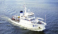
 Thomas Jefferson |
Poppe, L.J., Danforth, W.W., McMullen, K.Y., Parker, C.E., and Doran, E.F., 2011, Combined multibeam and LIDAR bathymetry data from eastern Long Island Sound and westernmost Block Island Sound-A regional perspective: U. S. Geological Survey Open-File Report 2011-1003, https://doi.org/10.3133/ofr20111003.
Poppe, L.J., McMullen, K.Y., Ackerman, S.D., Blackwood, D.S., Irwin, B.J., Schaer, J.D., Lewit, P.G., and Doran, E.F., 2010, Sea-floor geology and character offshore of Rocky Point, New York: U.S. Geological Survey Open-File Report 2010-1007, https://doi.org/10.3133/ofr20101007.
| Survey Equipment | Survey Info | Data Type(s) | Data Collected |
|---|---|---|---|
| Simrad EM 1000 | --- | Multibeam | Bathymetry GIS data |
| Reson 7125 | --- | Multibeam | |
| Klein 531 sidescan | --- | Sidescan | Sidescan mosaic |
| DGPS | --- | Navigation |