Other ID: D-40-08-CT
Status: Completed
Organization(s): USGS, Woods Hole Coastal and Marine Science Center
Funding Program(s):
Principal Investigator(s): Dann Blackwood
Affiliate Investigator(s): Jonathan Morrison, USGS Connecticut Water Science Center
Information Specialist(s): Dann Blackwood, PARTNER
Data Type(s): Imagery: Photo
Scientific Purpose/Goals: Install mounting rail for current meter in river.
Vehicle(s):
Start Port/Location: Middletown, CT
End Port/Location: Middletown, CT
Start Date: 2008-09-23
End Date: 2008-09-24
Equipment Used: Camera- deep sea, Digital camera
Information to be Derived:
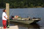
Summary of Activity and Data Gathered: Wooden supports were installed underwater and aluminum rail attached to wood supports and dock.
Staff: Dann Blackwood, Richard Rendigs
Affiliate Staff:
Jonathan Morrison
USGS Connecticut Water Science Center
supervisor; Jason Pollender
CWSC
installer; John Organek
CWSC
boat operator; Joe Martin
CWSC
technician
Notes: Location of rail is about: 41 32 28.85N 72 33 04.78W. Original Center People field contained: Dann Blackwood, lead diver; Rick Rendigs, diver.
Project = Diving Account, Diving Account
Location:
Connecticut River, Middletown, Connecticut, United States, North America;
| Boundaries | |||
|---|---|---|---|
| North: 41.6 | South: 41.51667 | West: -72.6667 | East: -72.53333 |
Platform(s):
 War Eagle |
| Survey Equipment | Survey Info | Data Type(s) | Data Collected |
|---|---|---|---|
| Camera- deep sea | --- | Photo | |
| Digital camera | --- | Photo | 2008-040-FA-PH-001 (43 operations/deck photos by Dann Blackwood.) |
