Other ID: Y-44-08-SC
Status: Completed
Organization(s): USGS, Woods Hole Coastal and Marine Science Center
Funding Program(s):
Principal Investigator(s): Jonathan Borden
Affiliate Investigator(s): Jonathan Warrick, USGS, Santa Cruz
Information Specialist(s): PARTNER
Data Type(s): Location-Elevation: Navigation, Time Series: Mooring (physical oceanography)
Scientific Purpose/Goals: Deploy moorings in support of Tijuana Estuary Sediment Fate and Transport Demo Project.
Vehicle(s):
Start Port/Location: SIO, San Diego, CA
End Port/Location: SIO, San Diego, CA
Start Date: 2008-10-23
End Date: 2008-10-28
Equipment Used: DGPS, Sensors - other mooring
Information to be Derived:
Summary of Activity and Data Gathered:
Staff: Jonathan Borden
Affiliate Staff:
Jonathan Warrick
Chief Scientist; Joanne Ferreira
Scientist; Kurt Rosenberger
Scientist; Dave Gonzales
Technician
Notes: No data returned to WHSC; contact Kurt Rosenberger, USGS PCMG. Original Center People field contained: Jonathan Borden, Mooring Tech.
Project = Tijuana Estuary Sediment Fate and Transport Demo Project, Tijuana Estuary Sediment Fate and Transport Demo Project
Location:
Tijuana River, San Diego, California, United States, North America, North Pacific;
| Boundaries | |||
|---|---|---|---|
| North: 32.58478 | South: 32.53003 | West: -117.2293 | East: -117.13222 |
Platform(s):
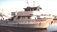 Yellowfin |
| Survey Equipment | Survey Info | Data Type(s) | Data Collected |
|---|---|---|---|
| DGPS | --- | Navigation | |
| Sensors - other mooring | --- | CTD Meteorology Temperature Mooring (physical oceanography) |
