Other ID: D-24-09-GK
Status: Completed
Organization(s): USGS, Woods Hole Coastal and Marine Science Center
Funding Program(s):
Principal Investigator(s): Page Valentine
Affiliate Investigator(s): Vince Guida, NOAA Fisheries
Information Specialist(s): Page Valentine
Data Type(s): Imagery: Photo, Imagery: Video, Location-Elevation: Navigation
Scientific Purpose/Goals: Habitat mapping on the northern part of Georges Bank.
Vehicle(s):
Start Port/Location: Woods Hole, MA
End Port/Location: Woods Hole, MA
Start Date: 2009-08-03
End Date: 2009-08-14
Equipment Used: SeaBOSS, Digital camera, GPS (wh)
Information to be Derived: Habitat maps;
Summary of Activity and Data Gathered: Collected video and photographic imagery from 128 locations on the northern edge of Georges Bank for the purpose of mapping sea floor habitats and the distribution of the invasive colonial tunicate Didemnum vexillum. Seabed imagery collected: 2728 digital still photographs archived on DVD; video transects archived on 51 DVDs and backed up on 25 8 mm video tapes. Data is archived at the USGS Woods Hole Coastal and Marine Science Center.
Staff: Dann Blackwood, Page Valentine
Affiliate Staff:
Vince Guida
Notes: Project = Benthic Habitats: Geological and Biological Studies, Benthic Habitats: Geological and Biological Studies
Location:
Georges Bank, United States, North America, North Atlantic,
| Boundaries | |||
|---|---|---|---|
| North: 42.11452 | South: 41.16211 | West: -68.5107 | East: -67.11548 |
Platform(s):
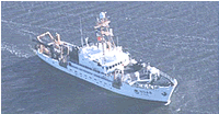 Delaware II |
| Survey Equipment | Survey Info | Data Type(s) | Data Collected |
|---|---|---|---|
| SeaBOSS | --- | Surveys (biological) Experiments (biological) Species ID Photo Video Geology Biology | 2009-024-FA-PH-001 (Still bottom photographs: 2,728 digital photos from 128 locations.) 2009-024-FA-PH-003 (DVD ROM disk of BOTTOM PHOTO GEORGES JD216-217, BOTTOM PHOTO GEORGES JD218-219, BOTTOM PHOTO GEORGES JD219-220, BOTTOM PHOTO GEORGES JD220-221, BOTTOM PHOTO GEORGES JD221-222, BOTTOM PHOTO GEORGES JD222-224, BOTTOM PHOTO GEORGES JD224-225, ) |
| Digital camera | --- | Photo | 2009-024-FA-PH-002 (Deck photos of field operations) |
| GPS (wh) | --- | Navigation |
