Other ID: none
Status: Completed
Organization(s): USGS, Woods Hole Coastal and Marine Science Center
Funding Program(s):
Principal Investigator(s): Carolyn Ruppel
Affiliate Investigator(s):
Information Specialist(s): Carolyn Ruppel
Data Type(s): Electro-Magnetic: Ground Penetrating Radar, Electro-Magnetic: Resistivity, Environmental Data: Gas Hydrates, Imagery: Photo, Location-Elevation: Navigation, Sampling: Chemistry, Sampling: Geology, Seismics: Sub Bottom Profiler, Sonar: Single Beam
Scientific Purpose/Goals: Collect geochemical and geophysical data in methane-emitting lakes. Study the physics, chemistry and biology associated with methane emissions from lakes in areas of discontinuous and continuous permafrost in Alaska.
Vehicle(s):
Start Port/Location:
End Port/Location:
Start Date: 2009-07-07
End Date: 2009-07-17
Equipment Used: Ground penetrating radar, Digital camera, Gas sampler, Pore water sampling, EdgeTech 424 chirp sub-bottom profiler, Humminbird fishfinder, AGI SuperSting, Gravity corer, DGPS
Information to be Derived:
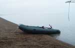
Summary of Activity and Data Gathered: Chirp seismic on multiple lakes on the North Slope and 2 lakes near Fairbanks; radar data on Lake Q on North Slope and 2 lakes near Fairbanks; resistivity on Lake Q; cores and gas samples from Lake Q and Killarney Lake near Fairbanks.
Staff: John Pohlman, Carolyn Ruppel, Charles Worley
Affiliate Staff:
UAF: Wooller (macrobiology)
Leigh (microbiology)
He (microbiology)
Gaglioti (macrobiology and coring)
Stewart (coring); UCSB: Heintz (biogeochemistry)
Notes: Original Center People field contained: Carolyn Ruppel (geophysics); John Pohlman (geochemistry); Chuck Worley (geophysics).
Project = High-Latitude Climate-Hydrates Interactions - Dept. of Energy, High-Latitude Climate-Hydrates Interactions - Dept. of Energy
Location:
1) Lake Qalluuraq, near Atqasuk, North Slope Borough, Alaska;2) Killarney Lake, near Fairbanks, Alaska;3) Goldstream Bill Lake, near Fairbanks, Alaska;4) Lake Teshekpuk, Alaska, United States, North America;
| Boundaries | |||
|---|---|---|---|
| North: 70.5 | South: 64.8 | West: -158.5 | East: -146.5 |
Platform(s):
 Tundra |
Wooller, M.J., Ruppel, C., Pohlman, J.W., Leigh, M.B., Heintz, M., and Anthony, K.W., 2009, Permafrost gas hydrates and climate change; lake-based seep studies on the Alaskan north slope: Fire in the Ice, U.S. Department of Energy/National Energy Technology Laboratory, Methane Hydrate Newsletter, Summer 2009, v. 9 no. 3, pp. 6–9, URL: http://www.netl.doe.gov/File%20Library/Research/Oil-Gas/methane%20hydrates/MHNewsSummer09.pdf.
| Survey Equipment | Survey Info | Data Type(s) | Data Collected |
|---|---|---|---|
| Ground penetrating radar | --- | Ground Penetrating Radar | |
| Digital camera | --- | Photo | |
| Gas sampler | --- | Dissolved Oxygen Gas Hydrates Methane | 2009-050-FA-SC-004 (Gas samples: gas samples from Lake Qalluuraq and Killarney Lake collected in glass vials for gas composition analysis.) |
| Pore water sampling | --- | Chemistry | 2009-050-FA-SC-002 (Pore water samples: samples from Lake Qalluuraq and Killarney Lake extracted from core with rhizons.) |
| EdgeTech 424 chirp sub-bottom profiler | --- | Sub Bottom Profiler | |
| Humminbird fishfinder | --- | Single Beam | |
| AGI SuperSting | --- | Resistivity | |
| Gravity corer | --- | Geology | 2009-050-FA-SC-001 (Sediment samples: small volume sediment samples from Lake Qalluuraq and Killarney Lake to be tested for water content and lipid biomarkers using standard gravimetric methods.) |
| DGPS | --- | Navigation |
