Other ID: P-1-09-AR
Status: Completed
Organization(s): USGS, Woods Hole Coastal and Marine Science Center
Funding Program(s):
Principal Investigator(s): Jonathan Borden
Affiliate Investigator(s): Tom Lorenson, USGS-Menlo Park
Information Specialist(s):
Data Type(s): Imagery: Photo, Imagery: Video
Scientific Purpose/Goals: Collect oil, asphalt and gas samples from natural hydrocarbon seeps from Prudhoe Bay, AK.
Vehicle(s):
Start Port/Location: Barrow, AK
End Port/Location: Barrow, AK
Start Date: 2009-09-15
End Date: 2009-09-26
Equipment Used: ROV
Information to be Derived:
Summary of Activity and Data Gathered: No ROV work accomplished due to weather; assisted with coring activities.
Staff: Jonathan Borden
Affiliate Staff:
Tom Lorenson
USGS-Menlo Park
Chief Scientist; Pat Hart
USGS-Santa Cruz
Bathymetry
Notes: Original Center People field contained: Jonathan Borden, ROV Pilot. Data Curator: Pat Hart, USGS - Santa Cruz.
Location:
Prudhoe Bay, Alaska, United States, North America, Beaufort Sea, Arctic Ocean;
| Boundaries | |||
|---|---|---|---|
| North: 73.30262 | South: 69.53452 | West: -156.665 | East: -141.37207 |
Platform(s):
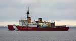 Polar Sea |
| Survey Equipment | Survey Info | Data Type(s) | Data Collected |
|---|---|---|---|
| ROV | --- | Photo Video Biology Geology | 2009-056-FA-SC-001 (Sediment cores) |
