Other ID: none
Status: Completed
Organization(s): USGS, Woods Hole Coastal and Marine Science Center
Funding Program(s):
Principal Investigator(s): Jane Denny
Affiliate Investigator(s): Dan Lizarralde, WHOI, and Brandon Dugan, Rice University
Information Specialist(s):
Data Type(s): Seismics: Sparker, Seismics: Multichannel
Scientific Purpose/Goals: High-resolution sub-bottom profiling of the inner continental shelf off Massachusetts coast. Multichannel seismic survey of outer continental shelf. Seismic data used in preparation for drilling to assess freshwater resources beneath the continental shelf. Collaborative work: USGS, WHOI, Scripps, Rice University.
Vehicle(s):
Start Port/Location: Narragansett, RI
End Port/Location: Narragansett, RI
Start Date: 2009-08-12
End Date: 2009-08-25
Equipment Used: Sparker , Multichannel seismics
Information to be Derived:
Summary of Activity and Data Gathered: High-resolution sub-bottom profiles of the inner continental shelf off Massachusetts coast were collected. Seismic data used in preparation for drilling to assess freshwater resources beneath the continental shelf. Collaborative work: USGS, WHOI, Scripps, Rice University.
Staff: Emile Bergeron, Brenton B. Taylor
Affiliate Staff:
Dan Lizarralde - WHOI; Brandon Dugan - Rice University; Ellett
Murphy
Dorrance - Scripps
Notes: Data Curator: URI.
Project = Marine Technology: Sea Floor Mapping, Marine Technology: Sea Floor Mapping
Location:
continental shelf, Martha's Vineyard, Massachusetts, United States, North America, North Atlantic;
| Boundaries | |||
|---|---|---|---|
| North: 41.5168 | South: 40.56389 | West: -70.8508 | East: -69.88403 |
Platform(s):
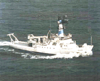 Endeavor |
| Survey Equipment | Survey Info | Data Type(s) | Data Collected |
|---|---|---|---|
| Sparker | --- | Sparker | |
| Multichannel seismics | --- | Multichannel | 2009-061-FA-SE-001 (Seismic reflection data.) |
