Other ID: none
Status: Completed
Organization(s): USGS, Woods Hole Coastal and Marine Science Center
Funding Program(s):
Principal Investigator(s): John Bratton, John Crusius, Kevin Kroeger, Christopher Sherwood
Affiliate Investigator(s):
Information Specialist(s): Adrian Green
Data Type(s): Environmental Data: Conductivity, Environmental Data: Current, Environmental Data: Nitrate, Location-Elevation: Navigation, Sampling: Chemistry
Scientific Purpose/Goals: Collect surface water samples in W. Falmouth Harbor for analysis of nutrients, dissolved greenhouse gases and radon. Collect continuous discharge, nitrate and salinity measurements at Mashapaquit Creek.
Vehicle(s):
Start Port/Location: Town Dock, W. Falmouth Harbor, W. Falmouth, MA
End Port/Location: Town Dock, W. Falmouth Harbor, W. Falmouth, MA
Start Date: 2009-09-17
End Date: 2009-09-22
Equipment Used: SUNA nitrate sensor, YSI multiparameter sonde, Water sampler, GPS (wh), ADCP
Information to be Derived:
Summary of Activity and Data Gathered: Collected surface water samples in W. Falmouth Harbor for analysis of nutrients, dissolved greenhouse gases and radon. Dissolved gases and radon samples were analyzed immediately. Nutrient samples were given to WHOI for analysis. Continuous discharge, nitrate, depth, temperature and salinity measurements were recorded at Mashapaquit Creek. Continuous radon, salinity and temperature measurements were recorded from a fixed raft in W. Falmouth Harbor.
Staff: Sandy Baldwin, John Bratton, Thomas Brooks, Michael Casso, John Crusius, Neil Kamal Ganju, Adrian Green, Kevin Kroeger, Marinna Martini, Christopher Sherwood
Affiliate Staff:
Notes: Work was divided into 2 separate trips, one on 9/17-9/18/09 and one on 9/22/09. Original Center People field contained: Mashapaquit Creek sampling - Kevin Kroeger, John Crusius, John Bratton, Sandy Baldwin, Wally Brooks; ADCP and nitrate measurements - Neil Ganju, Chris Sherwood, Marinna Martini; surface water sampling - Adrian Green, Michael Casso.
Project = Assessing Nitrogen: Western Long Island Sound, Assessing Nitrogen: Western Long Island Sound
Location:
West Falmouth Harbor, Falmouth, Buzzards Bay, Massachusetts, United States, North America, North Atlantic,
| Boundaries | |||
|---|---|---|---|
| North: 41.60941 | South: 41.59709 | West: -70.6498 | East: -70.63505 |
Platform(s):
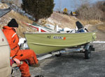 Terrapin |  on foot |
| Survey Equipment | Survey Info | Data Type(s) | Data Collected |
|---|---|---|---|
| SUNA nitrate sensor | --- | Nitrate | |
| YSI multiparameter sonde | --- | Conductivity Dissolved Oxygen ORP pH Temperature | |
| Water sampler | --- | Chemistry | 2009-067-FA-SC-001 (Surface water samples from W. Falmouth Harbor: to be analyzed for nutrients) 2009-067-FA-SC-002 (Surface water samples from W. Falmouth Harbor and Mashapaquit Ck. bridge: to be analyzed for greenhouse gases) 2009-067-FA-SC-003 (Surface water samples from W. Falmouth Harbor and Mashapaquit Ck. bridge: to be analyzed for radon) |
| GPS (wh) | --- | Navigation | |
| ADCP | --- | Current |
