Other ID: none
Status: Completed
Organization(s): USGS, Woods Hole Coastal and Marine Science Center
Funding Program(s):
Principal Investigator(s): Dann Blackwood
Affiliate Investigator(s): Mary Carman WHOI
Information Specialist(s): Dann Blackwood
Data Type(s): Imagery: Photo, Imagery: Video, Location-Elevation: Navigation
Scientific Purpose/Goals: Tunicate survey of Stonewall Pond.
Vehicle(s):
Start Port/Location: Stonewall Pond, Martha's Vineyard, MA
End Port/Location: Stonewall Pond, Martha's Vineyard, MA
Start Date: 2009-12-02
End Date: 2009-12-02
Equipment Used: Video camera - deep sea, Digital camera, DGPS
Information to be Derived: Invasive Tunicate Survey
Summary of Activity and Data Gathered: Micro-SEABOSS video survey.
Staff:
Affiliate Staff:
Danielle Ewart Oak Bluffs Shellfish Department
Deputy Shellfish Constable
Notes: Project = Benthic Habitats: Geological and Biological Studies, Benthic Habitats: Geological and Biological Studies
Location:
Stonewall Pond, Martha's Vineyard, Massachusetts, United States, North America, North Atlantic;
| Boundaries | |||
|---|---|---|---|
| North: 41.32932 | South: 41.32443 | West: -70.764 | East: -70.75461 |
Platform(s):
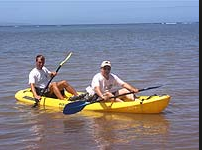 Kayak |
| Survey Equipment | Survey Info | Data Type(s) | Data Collected |
|---|---|---|---|
| Video camera - deep sea | --- | Video | |
| Digital camera | --- | Photo | 2009-090-FA-PH-001 (Deck photos of field activity operations) |
| DGPS | --- | Navigation | 2009-090-FA-LN-001 (Field activity track map - KLM format.) |
