Other ID: 2010-024-FA,M-24-10-GA
Status: Completed
Organization(s): USGS, Woods Hole Coastal and Marine Science Center
Funding Program(s):
Principal Investigator(s): John Crusius, John Crusius
Affiliate Investigator(s): Rob Campbell, Prince William Sound Science Center, Cordova, AK,Rob Campbell (Cordova, AK, Chief Scientist) - Prince William Sound Science Center
Information Specialist(s): Thomas Brooks, PARTNER
Data Type(s): Environmental Data: CTD, Environmental Data: Fluorescence, Location-Elevation: Navigation, Sampling: Chemistry, Environmental Data: Turbidity, Environmental Data: Conductivity, Environmental Data: Temperature
Scientific Purpose/Goals: Trace metal sampling in the Copper River region of the Gulf of Alaska.
Vehicle(s):
Start Port/Location: Cordova, AK and Cordova, AK
End Port/Location: Cordova, AK and Cordova, AK
Start Date: 2010-04-06
End Date: 2010-04-10
Equipment Used: SBE 9 CTD, Undulating towed instrument array (w/ ictd, fluorometer, etc., GPS (wh), Niskin bottle, Transmissometer, Seabird CTD, towed instrument array, ictd fluorometer
Information to be Derived: Time series data; Samples and chemical analysis; Suspended sediment concentrations;
Summary of Activity and Data Gathered: Surface-water samples and 5 water-column profiles collected.
Staff: Thomas Brooks, Andrew Schroth, Andrew Schroth, David Beam
Affiliate Staff:
Rob Campbell
Prince William Sound Science Center
Notes: Platform Owner: David Beam Days at Sea: 14 Navigation technique: gps; Degree of Certainty: 100% Science Strategy: Climate; Submitted by: John Crusius Report Date: 2010-05-11
Staff information imported from InfoBank
John Crusius - Chief Scientist
Rob Campbell (Cordova, AK, Chief Scientist) - Prince William Sound Science Center
Andrew Schroth - Wally Brooks
David Beam - captain
Non USGS data manager = Wally Brooks
Location:
North Pacific
| Boundaries | |||
|---|---|---|---|
| North: 61.75 | South: 54.25 | West: -155.75 | East: -132.25 |
Platform(s):
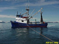 Montague |
| Survey Equipment | Survey Info | Data Type(s) | Data Collected |
|---|---|---|---|
| SBE 9 CTD | --- | CTD | |
| Undulating towed instrument array (w/ ictd, fluorometer, etc. | --- | CTD Fluorescence | |
| GPS (wh) | --- | Navigation | |
| Niskin bottle | --- | Chemistry | |
| Transmissometer | --- | Turbidity | |
| Seabird CTD | --- | CTD | |
| towed instrument array | --- | Conductivity Temperature | |
| ictd fluorometer | --- | Fluorescence |
