Other ID: S-P1-10-SC,2010-025-FA
Status: Completed
Organization(s): USGS, Woods Hole Coastal and Marine Science Center
Funding Program(s): California Urban Ocean (MU034)
Principal Investigator(s): Christopher Sherwood, Christopher Sherwood, Robert Eganhouse
Affiliate Investigator(s): Bob Eganhouse, USGS Reston
Information Specialist(s): Patrick Dickhudt, Christopher Sherwood
Data Type(s): Environmental Data: CTD, Imagery: Photo, Location-Elevation: Navigation, Sampling: Geology
Scientific Purpose/Goals: Sediment samples from Palos Verdes for size analysis, in conjunction with USGS Reston (Eganhouse) chemical sampling, funded by US EPA.
Vehicle(s):
Start Port/Location: Scripps MARFAC, San Diego and Scripps MARFAC, San Diego
End Port/Location: Scripps MARFAC, San Diego and Scripps MARFAC, San Diego
Start Date: 2010-04-22
End Date: 2010-04-25
Equipment Used: SBE 9 CTD, Digital camera, GPS (wh), Grab sampler, Box corer
Information to be Derived: Grain size analysis;
Summary of Activity and Data Gathered: WH group arrive San Diego Tues 20 April 2010; mob ship at Scripps Nimitz Marine Facility. Delay one day for weather, depart Scripps 1700 PDT 22 April. Arrive onsite 0600 PDT 23 April; Grab sample until noon; Eganhouse box core until midnight; grab sample until noon on 24 April; box core and CTD at 8C, 6C, and 3C on shelf until 1800; transit to San Pedro Channel; CTD and box core until 2200 PDT; transit back to port; arrive Scripps Marfac at 0845 PDT Sunday 25 April 2010. Unload ship and travel home.
Staff: Patrick Dickhudt, Charles Worley, Robert Eganhouse
Affiliate Staff:
Bob Eganhouse
USGS Reston
Bill Orem
USGS Reston
Erica DiFilippo
USGS Reston
Brian Edwards
USGS Menlo Park
Terry Lerch
USGS Reston
Tim Elfers
USGS Santa Cruz
Pete Dal Ferro
USGS Santa Cruz
Chuck Worley - Patrick Dickhudt
Rich Vullo - captain
Notes: Days at Sea: 4 Navigation technique: gps;Ships GPS and USGS-WCMG Yo-Nav system. Post-processing to a) compare locations from two systems and b) adjust for heading and distance from GPS antennae to fantail. Degree of Certainty: 100 Mooring Information: S-P1-10-SC Science Strategy: Ecosystems;Human Health; Submitted by: Chris Sherwood Report Date: 2010-06-30
Staff information imported from InfoBank
Chris Sherwood - Chief Scientist
Bob Eganhouse (Chief Scientist) - USGS Reston
Chuck Worley - Patrick Dickhudt
Rich Vullo - captain
Location:
North Pacific;
| Boundaries | |||
|---|---|---|---|
| North: 35.75 | South: 32.25 | West: -122.25 | East: -114.25 |
Platform(s):
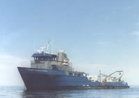 Robert Gordon Sproul |
| Survey Equipment | Survey Info | Data Type(s) | Data Collected |
|---|---|---|---|
| SBE 9 CTD | --- | CTD | |
| Digital camera | --- | Photo | |
| GPS (wh) | --- | Navigation | |
| Grab sampler | --- | Biology Geology | |
| Box corer | --- | Biology Geology |
