Other ID: none
Status: Completed
Organization(s): USGS, Woods Hole Coastal and Marine Science Center
Funding Program(s):
Principal Investigator(s): William Danforth
Affiliate Investigator(s):
Information Specialist(s): William Danforth
Data Type(s): Location-Elevation: Navigation, Sonar: Interferometric, Sonar: Multibeam
Scientific Purpose/Goals: Map the area where the Mass Maritime Academy training ship Kennedy resides.
Vehicle(s):
Start Port/Location: Barlows Landing, Bourne, MA
End Port/Location: Barlows Landing, Bourne, MA
Start Date: 2010-06-21
End Date: 2010-06-21
Equipment Used: DGPS, SEA SWATHplus-M 234 kHz
Information to be Derived:
Summary of Activity and Data Gathered: Swath bathymetric data were collected along the dock at the Mass Maritime Academy in the area where the Training Ship Kennedy is usually docked. This was an outreach effort to help MMA determine if there is any sediment deposition in that area when the Kennedy is not tied up as the ship is in dry dock now for maintenance.
Staff: Emile Bergeron, Barry Irwin
Affiliate Staff:
Notes:
Location:
Buzzards Bay, Cape Cod, Massachusetts, United States, North America, North Atlantic,
| Boundaries | |||
|---|---|---|---|
| North: 41.74109 | South: 41.73135 | West: -70.6308 | East: -70.62046 |
Platform(s):
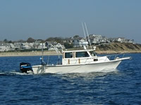
 Rafael |
| Survey Equipment | Survey Info | Data Type(s) | Data Collected |
|---|---|---|---|
| DGPS | --- | Navigation | |
| SEA SWATHplus-M 234 kHz | --- | Interferometric |