Other ID: none
Status: Completed
Organization(s): USGS, Woods Hole Coastal and Marine Science Center
Funding Program(s):
Principal Investigator(s): Dann Blackwood
Affiliate Investigator(s): Denis LeBlanc; Tim McCobb from WRD
Information Specialist(s): Sandy Baldwin
Data Type(s): Sampling: Biology, Sampling: Chemistry, Sampling: Geology, Location-Elevation: Navigation
Scientific Purpose/Goals: Groundwater sampling.
Vehicle(s):
Start Port/Location: Ashumet Pond, Falmouth, MA
End Port/Location: Ashumet Pond, Falmouth, MA
Start Date: 2010-08-03
End Date: 2010-08-03
Equipment Used: SCUBA, GPS (wh)
Information to be Derived: Well pressure measurement and water samples.
Summary of Activity and Data Gathered: WHSC role was strictly diver support. No data were collected by or returned to WHSC. Any data collected will be held, processed and published by project partners.
Staff: Sandy Baldwin
Affiliate Staff:
Notes: Tim McCobb phone # 508 490 5016. Related to 2009-057-FA.
Location:
Ashumet Pond, Falmouth/Mashpee, Massachusetts, United States, North America;
| Boundaries | |||
|---|---|---|---|
| North: 41.63477 | South: 41.63465 | West: -70.5402 | East: -70.54005 |
Platform(s):
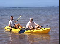 Kayak |
| Survey Equipment | Survey Info | Data Type(s) | Data Collected |
|---|---|---|---|
| SCUBA | --- | Biology Chemistry Geology | |
| GPS (wh) | --- | Navigation |
