Other ID: Chandeleur Islands
Status: Completed
Organization(s): USGS, Woods Hole Coastal and Marine Science Center
Funding Program(s):
Principal Investigator(s): Christopher Sherwood
Affiliate Investigator(s):
Information Specialist(s): Marinna Martini
Data Type(s): Location-Elevation: Navigation, Time Series: Mooring (physical oceanography), Visual Identification: Ground Truthing
Scientific Purpose/Goals: Recover four moorings near the Chandeleur Islands, Moorings #889-892. Deploy three buoys, redeploy tripods, moorings 893-899.
Vehicle(s):
Start Port/Location: Biloxi, MS
End Port/Location: Biloxi, MS
Start Date: 2010-09-09
End Date: 2010-09-16
Equipment Used: DGPS, Bottom platform, Mooring tripod, Turbidity, Current
Information to be Derived:
Summary of Activity and Data Gathered: Recovered tripods 889, 890, 891, 892. Deployed tripods and buoys 893-899.
Staff: Brandy Armstrong, Jonathan Borden, Patrick Dickhudt, Marinna Martini, Christopher Sherwood
Affiliate Staff:
Notes:
Location:
Chandeleur Islands, Gulf of America (Gulf of Mexico), North America, North Atlantic;
| Boundaries | |||
|---|---|---|---|
| North: 30.08098 | South: 29.59734 | West: -89.0771 | East: -88.56628 |
Platform(s):
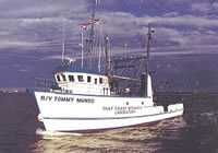 Tommy Munro |
| Survey Equipment | Survey Info | Data Type(s) | Data Collected |
|---|---|---|---|
| DGPS | --- | Navigation | |
| Bottom platform | --- | Mooring (physical oceanography) | |
| Mooring tripod | --- | Ground Truthing | |
| Turbidity | --- | Mooring (physical oceanography) | |
| Current | --- | Mooring (physical oceanography) |
