Other ID: none
Status: Completed
Organization(s): USGS, Woods Hole Coastal and Marine Science Center
Funding Program(s):
Principal Investigator(s): Page Valentine
Affiliate Investigator(s): Vince Guida, NOAA Fisheries
Information Specialist(s): Page Valentine
Data Type(s): Biological Field Study: Experiments (biological), Biological Field Study: Surveys (biological), Imagery: Photo, Imagery: Video, Location-Elevation: Navigation, Sampling: Biology, Sampling: Geology, Visual Identification: Species ID
Scientific Purpose/Goals: Habitat mapping on the northern part of Georges Bank.
Vehicle(s):
Start Port/Location: Woods Hole, MA
End Port/Location: Woods Hole, MA
Start Date: 2010-10-26
End Date: 2010-10-31
Equipment Used: SeaBOSS, Digital camera, GPS (wh)
Information to be Derived: Habitat maps;
Summary of Activity and Data Gathered: Collected photo and video imagery at 18 stations, collected sediment samples at 3 stations, and associated navigation data, on the northern part of Georges Bank.
Staff: Dann Blackwood
Affiliate Staff:
Vince Guida
Notes: Cruise dates changed due to required repairs to ship. Mobilization at the NMFS dock in Woods Hole on Friday, October 22, and Monday, October 25, 2010.
Project = Benthic Hab/Geol & Biol Studies, Benthic Hab/Geol & Biol Studies
Location:
Georges Bank, United States, North America, North Atlantic,
| Boundaries | |||
|---|---|---|---|
| North: 42.11452 | South: 41.16211 | West: -68.5107 | East: -67.11548 |
Platform(s):
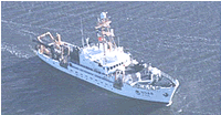 Delaware II |
| Survey Equipment | Survey Info | Data Type(s) | Data Collected |
|---|---|---|---|
| SeaBOSS | --- | Surveys (biological) Experiments (biological) Species ID Photo Video Geology Biology | |
| Digital camera | --- | Photo | 2010-082-FA-PH-002 (Photos of deck operations) |
| GPS (wh) | --- | Navigation |
