Other ID: none
Status: Completed
Organization(s): USGS, Woods Hole Coastal and Marine Science Center
Funding Program(s):
Principal Investigator(s): Jason Chaytor
Affiliate Investigator(s): Amanda Demopoulos, USGS, Southeast Ecological Science Center
Information Specialist(s): Jason Chaytor
Data Type(s): Sonar: Multibeam, Sonar: Sound Velocity, Location-Elevation: Navigation
Scientific Purpose/Goals: Map the shelf-edge offshore Virginia and Maryland in support of BOEMRE studies of the area
Vehicle(s):
Start Port/Location: Charleston, SC
End Port/Location: Charleston, SC
Start Date: 2011-06-04
End Date: 2011-06-17
Equipment Used: Simrad EM1002, Reson 7125, DGPS
Information to be Derived: Sea floor map;Bathymetric maps;
Summary of Activity and Data Gathered: Approximately 2,500 km of high resolution multibeam bathymetry data were collected covering Baltimore, Washington and Norfolk canyons and areas of the shelf and shelf-edge in between them. Additional data was collected off Cape Hatteras and during the transit legs from and to Charleston, SC.
Staff:
Affiliate Staff:
Dr Sandra Brooke (co-chief Scientist)
Marine Conservation Biology Institute
Steve W. Ross (co-chief Scientist)
UNC-W
Center for Marine Science
Rod Mather
Department of History
URI
Notes:
Project = NRC/Tsunami Landslide,
Location:
Shelf edge, Mid-Atlantic states, United States, North Atlantic
| Boundaries | |||
|---|---|---|---|
| North: 38.47939 | South: 36.43896 | West: -73.938 | East: -72.55371 |
Platform(s):
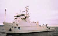 Nancy Foster |
Andrews, B.D., Chaytor, J.D., ten Brink, U.S., Brothers, D.S., Gardner, J.V., Lobecker, E.A., and Calder, B.R., 2013, Bathymetric terrain model of the Atlantic margin for marine geological investigations (ver. 2.0, May 2016): U.S. Geological Survey Open-File Report 2012–1266, 19 p., 1 pl., https://doi.org/10.3133/ofr20121266.
Chaytor, J.D., ten Brink, U.S., Baxter, C.D., Brothers, D.S., and Twichell, D.C, 2012, Submarine Landslides on the Slope and Rise, Southern New England Continental Margin, USA [abs.]: , 34th International Geological Congress. Brisbane, Australia, August 5-10, 2012.
Chaytor, J.D., ten Brink, U.S., Twichell, D.C., Baxter, C.D.P., Hallam, T.D., Brother, D., 2011, Submarine Landslides along the U.S. Atlantic Margin: Their Distribution, Failure Processes and Age [abs.]: , 2011 Fall AGU Meeting. December 5-9, 2011, San Francisco, CA.
ten Brink, U., Chaytor, J., Brothers, D., Twichell, D., Ross, S., and Brooke, S, 2011, New high resolution mapping of submarine canyons in the Mid-Atlantic Continental Margin [abs.]: , 2011 Fall AGU Meeting. San Francisco, CA, December 5-9, 2011.
| Survey Equipment | Survey Info | Data Type(s) | Data Collected |
|---|---|---|---|
| Simrad EM1002 | --- | Multibeam | |
| Reson 7125 | --- | Multibeam | |
| DGPS | --- | Navigation |
