Other ID: none
Status: Completed
Organization(s): USGS, Woods Hole Coastal and Marine Science Center
Funding Program(s):
Principal Investigator(s): Neil Kamal Ganju
Affiliate Investigator(s):
Information Specialist(s): Neil Kamal Ganju
Data Type(s): Environmental Data: CTD, Environmental Data: Meteorology, Environmental Data: Temperature, Time Series: Mooring (physical oceanography)
Scientific Purpose/Goals: Measure nitrate concentrations in Salt Pond, Nauset
Vehicle(s):
Start Port/Location: Salt Pond, MA
End Port/Location: Salt Pond, MA
Start Date: 2011-05-09
End Date: 2011-05-09
Equipment Used: Sensors - other mooring
Information to be Derived: Time series data;
Summary of Activity and Data Gathered: Vertical nitrate profiles
Staff:
Affiliate Staff:
Notes:
Project = Models for Changing Coastal Env,
Location:
Cape Cod National Seashore, Barnstable, Massachusetts, United States, North America, North Atlantic;,
| Boundaries | |||
|---|---|---|---|
| North: 41.83772 | South: 41.83344 | West: -69.9734 | East: -69.96849 |
Platform(s):
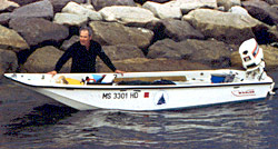 Limulus |
| Survey Equipment | Survey Info | Data Type(s) | Data Collected |
|---|---|---|---|
| Sensors - other mooring | --- | CTD Meteorology Temperature Mooring (physical oceanography) |
