Other ID: none
Status: Completed
Organization(s): USGS, Woods Hole Coastal and Marine Science Center
Funding Program(s): Law of the Sea - Outer Limits of the US Continental Margins (LQ000FQ)
Principal Investigator(s): Thomas O'Brien
Affiliate Investigator(s): Dr. Ginger Barth - USGS; Dr. Warren Wood - NRL; Patrick Hart - USGS
Information Specialist(s): Wayne Baldwin
Data Type(s): Location-Elevation: Navigation
Scientific Purpose/Goals: Collect seismic reflection and refraction data in the Bering Sea in order to apply the sediment thickness formula of Article 76 of the Convention on the Law of the Sea and determine the outer limits of the U.S. extended continental shelf.
Vehicle(s):
Start Port/Location: Dutch Harbor, AK
End Port/Location: Dutch Harbor, AK
Start Date: 2011-08-07
End Date: 2011-09-01
Equipment Used: GPS (wh)
Information to be Derived:
Summary of Activity and Data Gathered: MCS Seismic, Gravity, sonobuoy refraction, magnetometer, XBT, CTD, water samples, multi-beam bathymetry, Marine Mammal observations.
Staff: Wayne Baldwin, Thomas O'Brien
Affiliate Staff:
Notes: Chief Scientist Dr. Ginger Barth from Pacific Coastal and Marine Science Center (USGS)
Project = Law of the Sea,
Location:
Alaska, Bering Sea, Aleutian Basin
| Boundaries | |||
|---|---|---|---|
| North: 61.42475844 | South: 55.03923849 | West: -179.149 | East: -167.06878788 |
Platform(s):
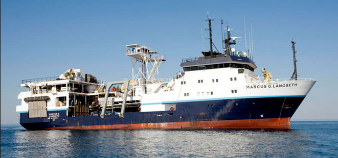
 Marcus G. Langseth |
Barth, G.A., Baldwin, W.E., Reece, R.S., Gulick, S.S., Danforth, W.W., and Wong, F.L., 2022, Multibeam bathymetry and acoustic backscatter from the Alaskan region, Extended Continental Shelf Project, 2011 field season: Gulf of Alaska and Bering Sea: U.S. Geological Survey data release, https://doi.org/10.5066/F7HM56HK.
Christeson, G.L., and Barth, G.A., 2015, Aleutian basin oceanic crust: Earth and Planetary Science Letters, v. 426, pp. 167–175, doi: 10.1016/j.epsl.2015.06.040.
| Survey Equipment | Survey Info | Data Type(s) | Data Collected |
|---|---|---|---|
| GPS (wh) | --- | Navigation |