Other ID: none
Status: Completed
Organization(s): USGS, Woods Hole Coastal and Marine Science Center
Funding Program(s):
Principal Investigator(s): Andrew Schroth
Affiliate Investigator(s):
Information Specialist(s): Thomas Brooks
Data Type(s): Environmental Data: CTD, Environmental Data: Temperature, Sampling: Chemistry
Scientific Purpose/Goals: Collect water samples
Vehicle(s):
Start Port/Location: Cordova, AK
End Port/Location: Cordova, AK
Start Date: 2011-07-22
End Date: 2011-08-03
Equipment Used: Temperature and salinity, Water sampler
Information to be Derived: Samples and chemical analysis;
Summary of Activity and Data Gathered: water samples
Staff: Thomas Brooks, Andrew Schroth
Affiliate Staff:
Notes: research cruise water sampling
Project = GC/Impact of Climate Chg Gulf AK,
Location:
Gulf of Alaska, Alaska, United States
| Boundaries | |||
|---|---|---|---|
| North: 59.53432 | South: 54.53432 | West: -145.195 | East: -140.19531 |
Platform(s):
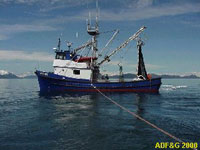 Montague |
| Survey Equipment | Survey Info | Data Type(s) | Data Collected |
|---|---|---|---|
| Temperature and salinity | --- | CTD Temperature | |
| Water sampler | --- | Chemistry |
