Other ID: HLY1102
Status: Completed
Organization(s): USGS, Woods Hole Coastal and Marine Science Center
Funding Program(s): Law of the Sea - Outer Limits of the US Continental Margins (LQ000FQ)
Principal Investigator(s): Brian Buczkowski
Affiliate Investigator(s): Larry Mayer, UNH (Chief Scientist); Andy Armstrong NOAA (Co-chief Scientist);
Information Specialist(s): Brian Buczkowski
Data Type(s): Sonar: Multibeam
Scientific Purpose/Goals: Collect data to define the extent of the extended continental shelf in the Arctic Ocean and also to make measurements on ocean acidification and gravity.
Vehicle(s):
Start Port/Location: Barrow, AK
End Port/Location: Dutch Harbor, AK
Start Date: 2011-08-15
End Date: 2011-09-28
Equipment Used: Simrad EM122
Information to be Derived: Samples and chemical analysis;Bathymetric maps;
Summary of Activity and Data Gathered: The primary mission of Healy cruise 1102 was to collect multibeam bathymetry. Data were also collected and processed from two BGM gravimeters onboard, and water samples were collected and processed to analyze oceanic geochemistry, isotopic ratios and dissolved carbon in the Arctic Ocean.
Staff:
Affiliate Staff:
Lisa Robbins - USGS St. Petersburg
Notes: NOAA/UNH cruise aboard USCG Cutter Healy
Project = Law of the Sea,
Location:
| Boundaries | |||
|---|---|---|---|
| North: 88.3 | South: 54 | West: -179.9 | East: -125 |
Platform(s):
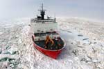 Healy |
| Survey Equipment | Survey Info | Data Type(s) | Data Collected |
|---|---|---|---|
| Simrad EM122 | --- | Multibeam Water column reflectivity |
