Other ID: Moorings 919-933
Status: Completed
Organization(s): USGS, Woods Hole Coastal and Marine Science Center
Funding Program(s): Hurricane Sandy - Linking Coastal Processes and Vulnerability – Fire Island Regional Study (AE03FJ6)
Principal Investigator(s): John Warner
Affiliate Investigator(s):
Information Specialist(s): Brandy Armstrong
Data Type(s): Environmental Data: CTD, Environmental Data: Temperature, Imagery: Photo, Imagery: Video, Location-Elevation: Navigation, Sampling: Biology, Sampling: Geology, Sonar: Single Beam, Time Series: Mooring (physical oceanography)
Scientific Purpose/Goals: Sett buoys and tripods, moorings 919-933
Vehicle(s):
Start Port/Location: Woods Hole, MA
End Port/Location: Woods Hole, MA
Start Date: 2012-01-23
End Date: 2012-01-26
Equipment Used: Bottom platform, Digital camera, Echosounder, HYPACK, SeaBOSS, Current, Pressure, Temperature and salinity, Turbidity, DGPS
Information to be Derived:
Summary of Activity and Data Gathered: 6 buoys and 9 tripods were deployed in two round trips to the experiment site. SEABOSS sampling and video were performed.
Staff: Brandy Armstrong, Sandy Baldwin, Jonathan Borden, Jeffrey List, Marinna Martini, Ellyn Montgomery, Jeffrey Obelcz, Charles Worley
Affiliate Staff:
Notes: Project = Long Island Barrier Island,
Location:
Fire Island, NY
| Boundaries | |||
|---|---|---|---|
| North: 40.65251 | South: 40.61187 | West: -73.287 | East: -73.15796 |
Platform(s):
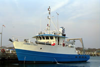
 Connecticut |
Armstrong, B.N., Warner, J.C., List, J.H., Martini, M.A., Montgomery, E.T., Voulgaris, George, and Traykovski, P.A., 2014, Coastal Change Processes Project data report for observations near Fire Island, New York, January to April 2012: U.S. Geological Survey Open-File Report 2014–1159, https://doi.org/10.3133/ofr20141159.
Warner, J.C., List, J.H., Schwab, W.C., Voulgaris, G., Armstrong, B., and Marshall, N., 2014, Inner-shelf circulation and sediment dynamics on a series of shoreface-connected ridges offshore of Fire Island, NY: Ocean Dynamics, vol. 64, p. 1767-1781, https://doi.org/10.1007/s10236-014-0781-y.
| Survey Equipment | Survey Info | Data Type(s) | Data Collected |
|---|---|---|---|
| Bottom platform | --- | Mooring (physical oceanography) | |
| Digital camera | --- | Photo | 2012-004-FA-PH-001 (photos taken during field operations) |
| Echosounder | --- | Single Beam | |
| HYPACK | --- | Navigation | |
| SeaBOSS | --- | Surveys (biological) Experiments (biological) Species ID Photo Video Geology Biology | |
| Current | --- | Mooring (physical oceanography) | |
| Pressure | --- | Mooring (physical oceanography) | |
| Temperature and salinity | --- | CTD Temperature | |
| Turbidity | --- | Mooring (physical oceanography) | |
| DGPS | --- | Navigation |