Other ID: none
Status: Completed
Organization(s): USGS, Woods Hole Coastal and Marine Science Center
Funding Program(s): CMG-WH Core Competency - Laboratories (LQ000GT)
Principal Investigator(s): Uri Ten Brink
Affiliate Investigator(s):
Information Specialist(s): Eric Moore, Jeffrey Obelcz, Charles Worley
Data Type(s): Location-Elevation: Navigation, Seismics: Multichannel, Seismics: Sparker, Seismics: Sub Bottom Profiler, Sonar: Sidescan
Scientific Purpose/Goals: Chirp and side-scan cruise
Vehicle(s):
Start Port/Location: Ocean City MD
End Port/Location: Ocean City, MD
Start Date: 2012-05-20
End Date: 2012-05-28
Equipment Used: Multichannel seismics, Edgetech chirp subbottom profiler 512i, Sparker , Edgetech Sidescan sonar, DGPS
Information to be Derived:
Summary of Activity and Data Gathered: almost 1000 km of chirp and side scan data collected around the Baltimore, Washington, and Norfolk canyons
Staff: Jeffrey Obelcz
Affiliate Staff:
Notes: Project = NRC/Tsunami Landslide,
Location:
Mid-Atlantic Bight, United States, North America, North Atlantic
| Boundaries | |||
|---|---|---|---|
| North: 38.27269 | South: 35.24562 | West: -73.8281 | East: -70.13672 |
Platform(s):
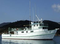
 Tiki XIV |
Obelcz, J.B., Brothers, D.S., ten Brink, U.S., Chaytor, J.D., Worley, C.R., and Moore, E.M., 2014, Chirp seismic-reflection data from the Baltimore, Washington, and Norfolk Canyons, U.S. mid-Atlantic margin: U.S. Geological Survey Open-File Report 2014–1118, https://doi.org/10.3133/ofr20141118.
| Survey Equipment | Survey Info | Data Type(s) | Data Collected |
|---|---|---|---|
| Multichannel seismics | --- | Multichannel | |
| Edgetech chirp subbottom profiler 512i | --- | Sub Bottom Profiler | |
| Sparker | --- | Sparker | |
| Edgetech Sidescan sonar | --- | Sidescan | |
| DGPS | --- | Navigation |