Other ID: none
Status: Completed
Organization(s): USGS, Woods Hole Coastal and Marine Science Center
Funding Program(s):
Principal Investigator(s): Daniel Brothers
Affiliate Investigator(s):
Information Specialist(s): Claudia Flores
Data Type(s): Seismics: Multichannel
Scientific Purpose/Goals: Map the Currituck landslide, slope stratigraphy and gas venting
Vehicle(s):
Start Port/Location: Ocean City MD
End Port/Location: Ocean City, MD
Start Date: 2012-07-17
End Date: 2012-07-24
Equipment Used: Multichannel seismics
Information to be Derived: Morphology;
Summary of Activity and Data Gathered: Three days of 72-ch sparker MCS data were collected. Cruise was cut short due to power plug failure for the sparker source.
Staff: Walter Barnhardt, Jason Chaytor, Eric Moore, Thomas O'Brien, Uri Ten Brink, Charles Worley
Affiliate Staff:
Notes:
Project = NRC/Tsunami Landslide,
Location:
Mid-Atlantic Bight, United States, North America, North Atlantic
| Boundaries | |||
|---|---|---|---|
| North: 37.8922 | South: 35.13788 | West: -73.9819 | East: -71.54297 |
Platform(s):
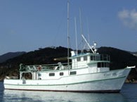 Tiki XIV |
| Survey Equipment | Survey Info | Data Type(s) | Data Collected |
|---|---|---|---|
| Multichannel seismics | --- | Multichannel |
