Other ID: HRS120928JC
Status: Completed
Organization(s): USGS, Woods Hole Coastal and Marine Science Center
Funding Program(s):
Principal Investigator(s): Jason Chaytor
Affiliate Investigator(s):
Information Specialist(s): Jason Chaytor
Data Type(s): Imagery: Photo, Location-Elevation: Navigation, Sampling: Geology, Seismics: Sub Bottom Profiler
Scientific Purpose/Goals: Piston core the Currituck landslide and landslide features south of Balitmore Canyon. Collect seafloor images from different environments within the Currituck Landslide.
Vehicle(s):
Start Port/Location: Lewes, DE
End Port/Location: Lewes, DE
Start Date: 2012-09-28
End Date: 2012-10-04
Equipment Used: Piston corer, Camera- deep sea, DGPS, Knudsen CHIRP Sub-bottom Profiler
Information to be Derived: Samples and chemical analysis;Grain size analysis;Physical property data;
Summary of Activity and Data Gathered: 24 Piston cores 5 TowCam stations (several thousand images) 3.5 kHz data
Staff: Brian Andrews, Uri Ten Brink
Affiliate Staff:
Chris Baxter
URI
Jenny White
USGS santa Cruz
Pete Dal Ferro
USGS Santa Cruz
Greg Coren
URI
Brian Baffer
URI
Laurette Roy
NOAA
Lizet Christiansen - WHOI/Seafloor Investigations
Osmond Manurung - URI
Notes: Project = NRC/Tsunami Landslide,
Location:
Mid-Atlantic Slope
| Boundaries | |||
|---|---|---|---|
| North: 38.42012346 | South: 36.01948414 | West: -74.83154366 | East: -73.17504902 |
Platform(s):
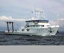
 Hugh R. Sharp |
Boggess, A.A., Buczkowski, B.J., and Chaytor, J.D., 2023, Sedimentological and geotechnical analyses of marine sediment cores from the Currituck Landslide Complex and upper slope adjacent to Baltimore Canyon collected on USGS Field Activity 2012-007-FA: U.S. Geological Survey data release, https://doi.org/10.5066/P9H74BAX.
Chaytor, J.D., ten Brink, U.S., and Baxter, C.D., 2023, Late Pleistocene-Holocene age and stratigraphy of the Currituck Slide Complex, U.S. mid-Atlantic continental slope— Implications for landslide triggering: Marine Geology, vol. 462, https://doi.org/10.1016/j.margeo.2023.107080.
| Survey Equipment | Survey Info | Data Type(s) | Data Collected |
|---|---|---|---|
| Piston corer | This piston corer also had a trigger corer which is a small gravity corer that is attached to the piston coring system. Successful deployment of the system acquires a piston core as well as a trigger core that was collected right next to it. | Geology | HRS1209_CarbonateContent (Bulk organic matter and carbonate content of sediment cores from the Currituck Landslide Complex and upper slope adjacent to Baltimore Canyon collected on USGS Field Activity 2012-007-FA) HRS1209_CoreLocations (Locations of sediment cores from the Currituck Landslide Complex and upper slope adjacent to Baltimore Canyon collected on USGS Field Activity 2012-007-FA) HRS1209_GrainSize (Grain-size analyses of sediment cores from the Currituck Landslide Complex and upper slope adjacent to Baltimore Canyon collected on USGS Field Activity 2012-007-FA) HRS1209_MSCL (Multi-sensor core logger (MSCL) data of sediment cores from the Currituck Landslide Complex and upper slope adjacent to Baltimore Canyon collected on USGS Field Activity 2012-007-FA. The XLSX file has a separate sheet for each core that has data.) HRS1209_UndrainedShearStrength (Undrained shear strength of sediment cores from the Currituck Landslide Complex and upper slope adjacent to Baltimore Canyon collected on USGS Field Activity 2012-007-FA) HRS1209_WaterContent (Water content analyses of sediment cores from the Currituck Landslide Complex and upper slope adjacent to Baltimore Canyon collected on USGS Field Activity 2012-007-FA) HRS1209_VisualCoreDescriptions (Visual description sheets of sediment cores from the Currituck Landslide Complex and upper slope adjacent to Baltimore Canyon collected on USGS Field Activity 2012-007-FA) HRS1209_Xradiograph (X-radiographs of sediment cores from the Currituck Landslide Complex and upper slope adjacent to Baltimore Canyon collected on USGS Field Activity 2012-007-FA. Multiple JPEG images for each core that was x-rayed.) |
| Camera- deep sea | --- | Photo | |
| DGPS | --- | Navigation | 2012-007-FA_R2Rnavigation (Processed navigation archived on the Rolling Deck to Repository (R2R) site. The navigation is specified as being for the University of Delaware Surface Mapping System (SMS) acquisition.) |
| Knudsen CHIRP Sub-bottom Profiler | --- | Sub Bottom Profiler | 2012-007-FA_R2RKnudsen (Knudsen chirp subbottom data archived on the Rolling Deck to Repository (R2R) site. The data are not available by direct download and must be requested. The files are listed in the file manifest.) |