Other ID: none
Status: Completed
Organization(s): USGS, Woods Hole Coastal and Marine Science Center
Funding Program(s):
Principal Investigator(s): Bradford Butman
Affiliate Investigator(s):
Information Specialist(s): Sandy Baldwin, Bradford Butman
Data Type(s): Imagery: Video, Location-Elevation: Navigation, Sampling: Geology
Scientific Purpose/Goals: Obtain photographs of the sea floor and sediment samples at approximatley 100 stations in the Gulf of Maine as part of a WHOI survey to map the concentration of red-tide cysts in the bottom sediments.
Vehicle(s):
Start Port/Location: Narragansett, RI
End Port/Location: Narragansett, RI
Start Date: 2012-10-24
End Date: 2012-11-03
Equipment Used: Video camera - deep sea, GPS (wh), Craib corer
Information to be Derived: Grain size analysis;
Summary of Activity and Data Gathered: Videos were taken of the seafloor from a camera mounted on the Craib corer. Samples for sediment texture were obtained from the Craib sample.
Staff: Sandy Baldwin, Adrian Green
Affiliate Staff:
Notes: Project = Models for Changing Coastal Env,
Location:
Gulf of Maine, United States, North America, North Atlantic;,
| Boundaries | |||
|---|---|---|---|
| North: 45 | South: 41.5 | West: -71 | East: -66 |
Platform(s):
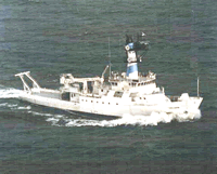 Endeavor |
| Survey Equipment | Survey Info | Data Type(s) | Data Collected |
|---|---|---|---|
| Video camera - deep sea | --- | Video | |
| GPS (wh) | --- | Navigation | |
| Craib corer | --- | Geology |
