AKA: none
Other ID: none
Status: Completed
Organization(s): Other
Funding Program(s): Other (Other)
Principal Investigator(s): Other
Affiliate Investigator(s): Peter Haeussler, co-PI, USGS Alaska Science Center Sean Gulick, co-PI, University of Texas Institute for Geophysics
Information Specialist(s): Patrick Hart
Data Type(s): Location-Elevation: Navigation, Seismics: Air Gun / Water Gun, Seismics: Sub Bottom Profiler
Scientific Purpose/Goals: The purpose of the cruise was to look for active faults, particularly those related to the 1899 earthquakes in the Yakutat Bay
Vehicle(s): None
Start Port/Location: Whittier, Alaska
End Port/Location: Seward, Alaska
Start Date: 2012-08-07
End Date: 2012-08-17
Equipment Used: navigation, Other, Other, Other
Information to be Derived: Holocene stratigraphy and structure
Summary of Activity and Data Gathered:
Staff:
Affiliate Staff:
Notes: Peter Haeussler, USGS, Alaska Science Center is affiliation of co-PI
Location:
Alaska, Yakutat Bay, Disenchantment Bay
| Boundaries | |||
|---|---|---|---|
| North: 60.24526401 | South: 59.49849932 | West: -140.1416 | East: -139.15608724 |
Platform(s):
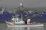
 Alaskan Gyre |
Gulick, S., LeVoir, M., Haeussler, P., Saustrup, S., 2012, Evaluating Active Faulting and Geohazards in the Yakutat Bay Region of Southeastern Alaska: U. S. Geological Survey Final Technical Report G12AP20009.
| Survey Equipment | Survey Info | Data Type(s) | Data Collected |
|---|---|---|---|
| navigation | --- | Navigation | |
| Other | --- | --- | --- |
| Other | --- | --- | --- |
| Other | --- | --- | --- |