Other ID: none
Status: Completed
Organization(s): USGS, Woods Hole Coastal and Marine Science Center
Funding Program(s):
Principal Investigator(s): Katherine McMullen, Lawrence Poppe
Affiliate Investigator(s):
Information Specialist(s): Katherine McMullen
Data Type(s): Biological Field Study: Experiments (biological), Biological Field Study: Surveys (biological), Imagery: Photo, Imagery: Video, Sampling: Biology, Sampling: Geology, Visual Identification: Species ID, Location-Elevation: Navigation
Scientific Purpose/Goals: Verify 2 NOAA hydrographic surveys in western Block Island Sound
Vehicle(s):
Start Port/Location: Stonington, CT
End Port/Location: Stonington, CT
Start Date: 2013-06-17
End Date: 2013-06-21
Equipment Used: SeaBOSS, DGPS
Information to be Derived: Grain size analysis;Sea floor map;Morphology;Physical property data;
Summary of Activity and Data Gathered: SeaBOSS operations to collect sediment samples and still and video photography
Staff: Dann Blackwood, Barry Irwin
Affiliate Staff:
Notes: We intend to ground truth surveys H12298 and H12299 and to use the acoustics, sediment samples, and bottom photography to produce geologic interpretations of the Block Island Sound seabed
Project = Sea & Lake/Data off Cape Cod,
Location:
Block Island Sound, Rhode Island, North Atlantic
| Boundaries | |||
|---|---|---|---|
| North: 41.28813 | South: 41.07832 | West: -71.9879 | East: -71.83685 |
Platform(s):
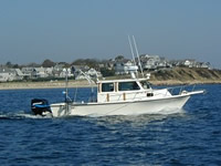
 Rafael |
McMullen, K.Y., Poppe, L.J., Danforth, W.W., Blackwood, D.S., Clos, A.R., and Parker, C.E., 2014, Sea-floor morphology and sedimentary environments of western Block Island Sound, northeast of Gardiners Island, New York: U.S. Geological Survey Open File Report 2014-1160, https://doi.org/10.3133/ofr20141160.
McMullen, K.Y., Poppe, L.J., Danforth, W.W., Blackwood, D.S., Winner, W.G., and Parker, C.E., 2015, Sea-floor morphology and sedimentary environments in western Block Island Sound, offshore of Fishers Island, New York: U.S. Geological Survey Open-File Report 2014-1224, https://doi.org/10.3133/ofr20141224.
FAN 2013-005-FA has data viewable in the CMGP Video and Photograph Portal. View the data in this application here. See the instructions for working with this application.
| Survey Equipment | Survey Info | Data Type(s) | Data Collected |
|---|---|---|---|
| SeaBOSS | --- | Surveys (biological) Experiments (biological) Species ID Photo Video Geology Biology | |
| DGPS | --- | Navigation |