Other ID: none
Status: Cancelled
Organization(s): USGS, Woods Hole Coastal and Marine Science Center
Funding Program(s):
Principal Investigator(s): Uri Ten Brink
Affiliate Investigator(s):
Information Specialist(s): Claudia Flores
Data Type(s): Seismics: Multichannel, Seismics: Sparker
Scientific Purpose/Goals: Map the continental shelf and slope near the Munson-Nygren canyons
Vehicle(s):
Start Port/Location: Woods Hole
End Port/Location: Woods Hole
Start Date: 2013-08-06
End Date: 2013-08-14
Equipment Used: Multichannel seismics, Sparker
Information to be Derived: Bathymetric maps;
Summary of Activity and Data Gathered:
Staff: Wayne Baldwin, Jason Chaytor, Eric Moore, Thomas O'Brien
Affiliate Staff:
Notes:
Project = NRC/Tsunami Landslide,
Location:
Georges Bank, United States, North America, North Atlantic;,
| Boundaries | |||
|---|---|---|---|
| North: 41.01307 | South: 40.33398 | West: -67.3462 | East: -66.10474 |
Platform(s):
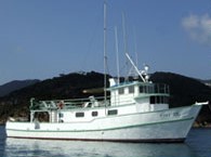 Tiki XIV |
| Survey Equipment | Survey Info | Data Type(s) | Data Collected |
|---|---|---|---|
| Multichannel seismics | --- | Multichannel | |
| Sparker | --- | Sparker |
