Other ID: none
Status: Completed
Organization(s): USGS, Woods Hole Coastal and Marine Science Center
Funding Program(s):
Principal Investigator(s): Brian Andrews
Affiliate Investigator(s): Jennifer Miselis (PI) USGS St. Petersburg
Information Specialist(s): Brian Andrews
Data Type(s): Sonar: Interferometric, Location-Elevation: Navigation, Biological Field Study: Experiments (biological), Biological Field Study: Surveys (biological), Imagery: Photo, Imagery: Video, Sampling: Biology, Sampling: Geology, Visual Identification: Species ID, Sonar: Sound Velocity, Sonar: Sidescan, Seismics: Sub Bottom Profiler
Scientific Purpose/Goals: Complete marine geophysical survey of Barnegat Bay and Little Egg Harbor, NJ
Vehicle(s):
Start Port/Location: Tuckerton, NJ
End Port/Location: Tuckerton, NJ
Start Date: 2013-09-09
End Date: 2013-09-19
Equipment Used: SeaBOSS, Digital video camera, Canon G12, SEA SWATHplus-H 468 kHz, HYPACK, Sensor - SVP, DGPS, Real Time Kinematic GPS, EdgeTech 424 chirp sub-bottom profiler, Edgetech 4200 sidescan
Information to be Derived: Grain size analysis;Sea floor map;Bathymetric maps;
Summary of Activity and Data Gathered: Conducted 6 days of geophysical mapping during 12 hour days on R/V Rafael working from Tuckerton, NJ. 1 day of SEABOSS samples/video/photos, Collected approximately 280 kms of bathymetry, backscatter, and seismics. Occupied 15 SEABOSS stations and collected sediment samples, bottom video and photography at each station
Staff: Dann Blackwood, William Danforth, Barry Irwin
Affiliate Staff:
Notes:
Project = Barnegat Bay Seafloor Mapping,
Location:
Little Egg Harbor, New Jersey, Barnegat Bay, New Jersey, United States, North America
| Boundaries | |||
|---|---|---|---|
| North: 39.62038181 | South: 39.46117244 | West: -74.33074951 | East: -74.2409516 |
Platform(s):
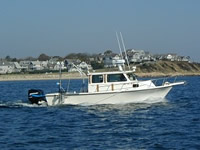
 Rafael |
Andrews, B.D., Miselis, J.L., Danforth, W.W., Irwin, B.J., Worley, C.R., Bergeron, E.M., and Blackwood, D.S., 2015, Marine geophysical data collected in a shallow back-barrier estuary, Barnegat Bay, New Jersey (ver. 1.1, September 2016): U.S. Geological Survey Data Series 937, 15 p., https://doi.org/10.3133/ds937.
Andrews, B.D., Defne, Z., Miselis, J.L., and Ganju, N.K., 2015, Continuous terrain model for water circulation studies, Barnegat Bay, New Jersey, U. S. Geological Survey data release, https://doi.org/10.5066/F7PK0D6B.
| Survey Equipment | Survey Info | Data Type(s) | Data Collected |
|---|---|---|---|
| SeaBOSS | Stainless steel framework that measures 1.1 x 1.1 meters and weighs 167 kilograms overall. House a van veen grab sampler as well as a having a digital camera and video camera mounted on the frame. | Surveys (biological) Experiments (biological) Species ID Photo Video Geology Biology | |
| Digital video camera | Video camera mounted on the SEABOSS frame | Video | |
| Canon G12 | Canon PowerShot G12, is mounted in a machined Delrin housing with a flat port and mounted on the SEABOSS frame. | Photo | |
| SEA SWATHplus-H 468 kHz | --- | Interferometric | |
| HYPACK | --- | Navigation | |
| Sensor - SVP | --- | Sound Velocity | |
| DGPS | --- | Navigation | |
| Real Time Kinematic GPS | --- | Navigation | |
| EdgeTech 424 chirp sub-bottom profiler | --- | Sub Bottom Profiler | |
| Edgetech 4200 sidescan | --- | Sidescan | LittleEggHbrBS_1m (One meter mosaic of acoustic backscatter data acquired using an EdgeTech 4200 sidescan sonar within Little Egg Harbor (Barnegat Bay) New Jersey by the U.S. Geological Survey in 2013) |